


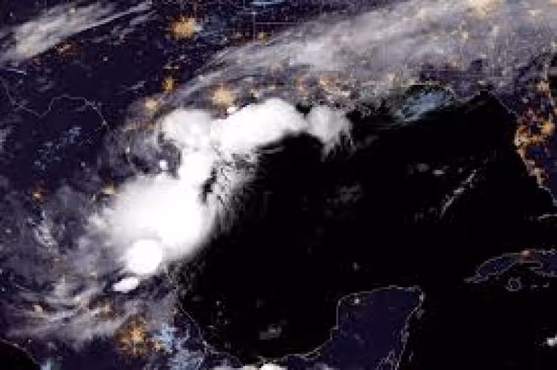
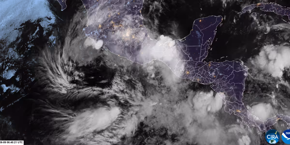
A broad area of disorganized showers and thunderstorms near the Texas‑Mexico border is being monitored because it could reemerge over the northwestern Gulf and briefly form the season's first named storm — Arthur — later Tuesday or Wednesday while producing intense rainfall that threatens life‑threatening flash flooding across the Gulf Coast and Lower Mississippi Valley.
The stakes are large: millions of people from southern and eastern Texas through Louisiana and into Mississippi face several days of heavy rain. Flood watches from the National Weather Service were in place Tuesday morning across southern and southeastern Texas, much of Louisiana and roughly the southern half of Mississippi, and forecasters warned that rainfall rates in the strongest storms could reach 2 to 4 inches per hour.
The National Hurricane Center summed up the short‑term potential in an early‑morning update Tuesday: "The system could reemerge over the northwestern Gulf of America today, and environmental conditions there are expected to be marginally conducive for the formation of a short-lived tropical storm later today or on Wednesday." If a tropical storm does form, the first name on this year's list is Arthur, and tropical storm watches or warnings are possible if development continues.
That immediate risk of heavy rain sits against the calendared start of the hurricane season. The Atlantic hurricane season began on June 1 and runs through November; the National Oceanic and Atmospheric Administration is forecasting a below‑normal season this year, with eight to 14 named storms. Still, early‑season tropical disturbances in the tropics can produce concentrated bursts of rainfall even when the overall season is quieter.
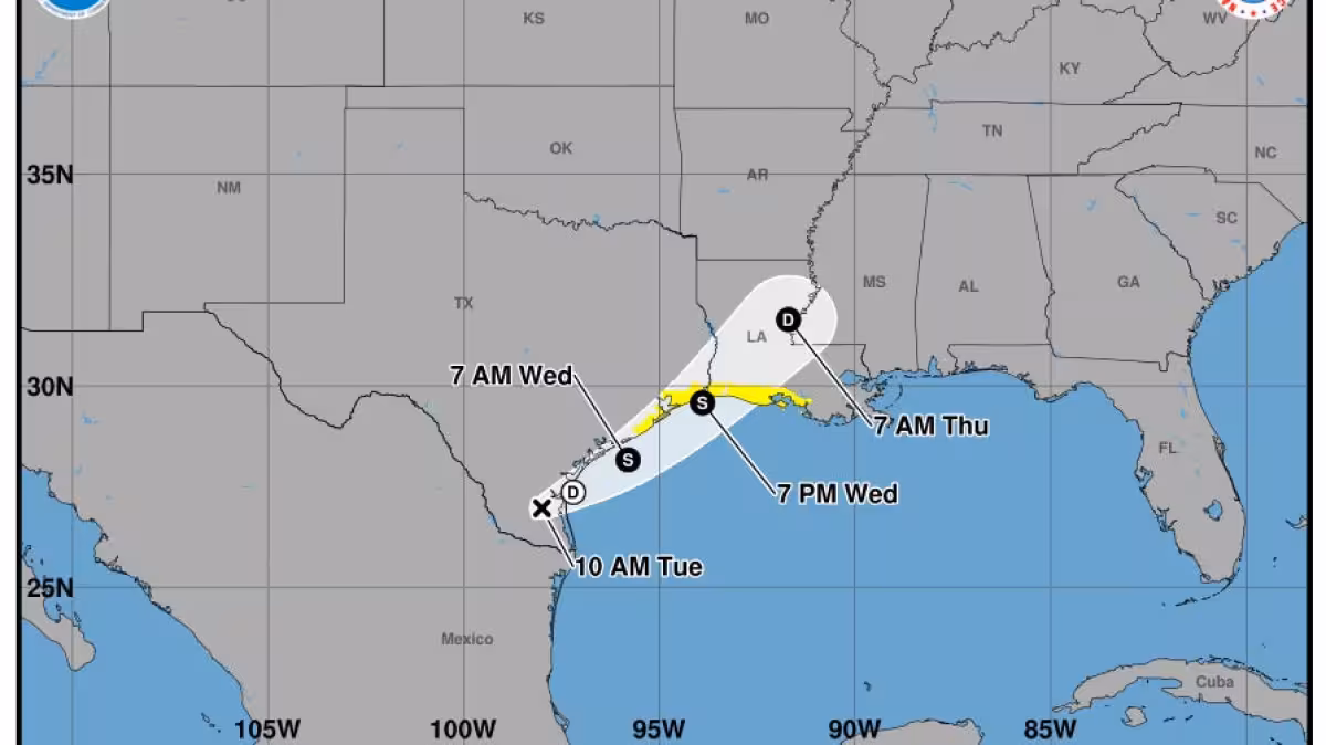
The forecast agencies emphasize a key friction point: the system may be only a short‑lived tropical storm, but the rain threat does not depend on a name. "Regardless of tropical cyclone formation, interests across southern and eastern Texas and portions of Louisiana and Mississippi should prepare for periods of intense rainfall over the next several days which could produce widespread, life-threatening flash, urban, and river flooding," the National Hurricane Center warned.
Private forecasters have been sounding the same alarm. AccuWeather cautioned Monday that a "tropical rainstorm" could form on Tuesday — a term it uses for tropical systems that may not be named but still pose flooding danger — and projects the disturbance could spread heavy rain from eastern Mexico through Texas and parts of the Gulf Coast before tracking northeastward later this week. Forecasters also warned gusty winds and coastal flooding could affect parts of the northwestern Gulf Coast during the event.
Practical impacts hinge on where the heaviest bands set up. The strongest storms could drop the most intense rates — 2 to 4 inches per hour — which, over low‑lying or saturated ground, would drive rapid flash, urban and river flooding. The National Hurricane Center said it will continue to monitor the disturbance and is expected to provide regular updates via its website; officials also noted that flood watches already in effect should be treated as an immediate call to prepare.
As forecasters weigh development, the same theme keeps returning: even if the system never achieves a long‑lived tropical‑cyclone status, the rainfall itself can be the primary hazard. "This week is especially concerning due to repeated rounds of torrential rain fueled by tropical moisture and perhaps a tropical rainstorm," meteorologist Dan DePodwin said, underscoring the expectation of multiple heavy‑rain episodes. The unresolved question now is not only whether the system will earn the name Arthur, but exactly where the heaviest, most damaging rainfall bands will stall — and the answer will depend on the NHC's updates and shifting steering patterns later this week.


