


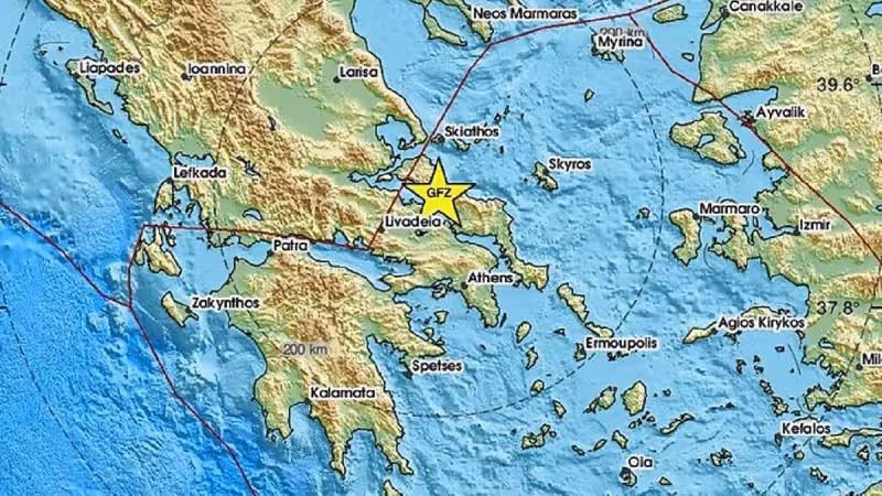
A 5.2-magnitude earthquake struck Greece on Sunday, June 7 at 1:02 p.m. Eastern European time, centered about 50 miles northwest of Athens.
Subsequent quakes were reported in the same area after the initial event, and shake data was current as of 3:29 p.m. Eastern European time on Sunday, with aftershocks information current as of Monday at 10:07 p.m. Eastern European time.
Seismologists cautioned that the 5.2 reading — the reported magnitude on the earthquake scale — may be revised as they review available data, and U.S.G.S. scientists may update the shake-severity map if additional information changes assessments of where and how strongly people felt the shaking.
The map and accompanying charts use aftershock data collected within 100 miles of the initial epicenter and track events occurring within seven days of the first quake, a window intended to capture the cluster of tremors that often follows a mainshock.
Shaking categories on the shake-severity map are based on the Modified Mercalli Intensity scale, a felt-intensity measure distinct from magnitude readings; the map shows where shaking reached particular intensity levels, while the magnitude number describes the earthquake’s energy release.
Aftershocks have already been reported in the same area, and experts note that aftershocks can occur days, weeks or even years after an initial earthquake. They also can be of equal or larger magnitude than the first quake, a reminder that a moderate mainshock can be followed by stronger or comparably strong events.
The immediate consequence for people in and near the area about 50 miles northwest of Athens is a higher probability of additional shaking in the coming days as the sequence unfolds. Authorities and residents use the shake-severity map to track which communities reported stronger shaking and to prioritize inspections and responses.
The central unresolved question now is whether the initial 5.2 magnitude will stand after routine reassessment of seismic records and whether U.S.G.S. scientists will alter the shake-severity map to reflect any new analysis. The agencies reviewing the data will determine both the final magnitude number and whether the intensity footprint that people saw on maps should be changed.
Given that seismologists routinely refine measurements as more stations and waveforms are analyzed, readers should expect updates: the 5.2 figure is the best available reading for the moment, and the shake-severity map remains subject to revision if later data shifts the picture of how strongly different areas were shaken.


