


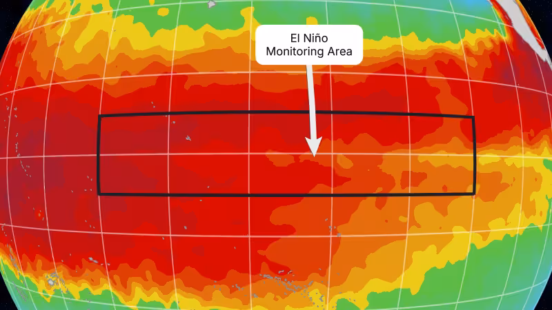
Ocean temperatures across the tropical Pacific have climbed close to the technical threshold for El Niño and the U.S. government’s Climate Prediction Center will issue its regular monthly update on Thursday, June 11, a date scientists say could decide whether conditions are formally declared.
Weekly sea‑surface temperature anomalies in the Niño‑3.4 region have recently reached about 0.5 degrees Celsius above average — the same value NOAA uses as a baseline — but the agency’s definition also requires those anomalies to be forecast to persist for five consecutive, overlapping three‑month seasons before a formal El Niño label is applied.
The signal beyond just the Niño‑3.4 numbers is growing: satellite data in mid‑May showed seas off Peru more than 5.9 inches, about 15 centimeters, above long‑term averages, and both NOAA and the World Meteorological Organization place roughly an 80% chance that El Niño will form between June and August and about a 90% chance it will persist into late 2026. Some forecast models now suggest the developing event could reach moderate or strong levels by late 2026.
Put plainly, El Niño is defined by sustained warming of the central and eastern equatorial Pacific rather than a single warm week. The Niño‑3.4 area is the thermometer scientists watch: NOAA requires at least 0.5 degrees Celsius above average and a multi‑season forecast for that warmth. That emphasis on persistence explains why, despite weekly readings near the threshold, the official status remains neutral for now.
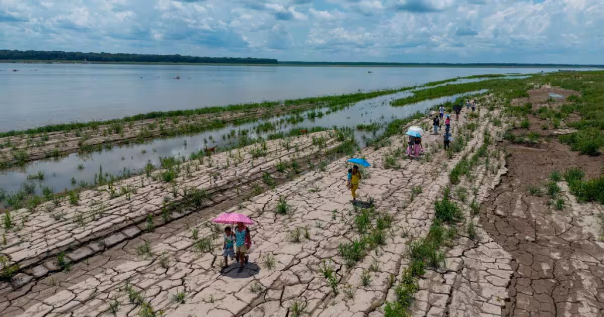
The practical stakes are immediate and global. El Niño can increase rainfall in some regions while worsening drought in others; it can shift winter storm tracks, alter hurricane activity, and push up global temperatures. Human‑caused warming that has already heated the atmosphere and oceans can amplify those effects, making a developing El Niño potentially more disruptive than similar events decades ago.
United Nations Secretary‑General António Guterres framed the risk bluntly: "El Niño is arriving on our doorstep in the coming months with 90 percent certainty" and warned that, "The world must treat it as the urgent climate warning it is. El Niño conditions will pour fuel on the fire of a warming world. Impacts will hit even harder, travel even farther, and cross borders with devastating speed."
The friction in the current picture is procedural as much as physical: weekly sea‑surface temperatures are hovering around the 0.5 degrees Celsius mark, but the declaration hinges on persistence and forecasted continuity over overlapping three‑month periods. That gap between short‑term readings and the formal criteria is why forecasters still list the official status as neutral even while raising the probability of development.
What happens next is clear on the calendar. NOAA’s Climate Prediction Center publishes its monthly update on June 11 — the next confirmed decision point. That report will weigh recent weekly anomalies, the multi‑model outlooks that project continuation, and the requirement that the warming persist across seasons; it will either move the status from neutral to an El Niño advisory or keep watchful caution in place. Even if the label is delayed, the current odds and satellite readings mean regions that typically face heavier rains, drought, altered hurricane seasons, or warmer global averages should be tracking forecasts and preparing for amplified impacts through late 2026.


