


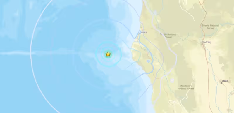
A 5.1-magnitude earthquake struck in the North Pacific Ocean Wednesday at 5:45 a.m. Pacific time about 40 miles west of Petrolia, California, shaking communities along the North Coast and prompting reports of additional quakes in the same offshore area.
Early felt reports reached local reporting services from Arcata and Ferndale, and later responses extended from Westport in Mendocino County to Blue Lake. The initial event was first logged as magnitude 4.8 before seismologists upgraded it to 5.1 as more data were reviewed.
Within the hour, a 4.5-magnitude quake was recorded at 6:11 a.m. off the coast of Ferndale, and another 3.8-magnitude event occurred around 8:50 a.m. The United States Geological Survey said subsequent quakes have been reported in the same area and that scientists are tracking the sequence.
The numerical detail gives the morning its weight: a mainshock now measured at 5.1, followed by at least two smaller quakes within a few hours. Those figures are what make this more than a distant tremor — residents from the gaslit towns of Humboldt County to Mendocino County felt the shaking and filed reports used to map intensity on the ground.
Context from the USGS underscores what seismologists will do next. The agency said additional information may prompt updates to the official shake-severity map, which translates instrument readings and citizen reports into a picture of where shaking was strongest. The USGS also reminded that aftershocks can follow an initial event for days, weeks or even years, depending on the fault activity.

The morning contained a clear friction point between rapid, initial reporting and later revisions. The quake was recorded quickly and released to the public as magnitude 4.8; that number was revised upward to 5.1 after analysts rechecked seismic data. That change matters because it alters expected shaking patterns and the boundaries where damage, if any, would be most likely.
Another unresolved element is whether the smaller quakes later in the morning are direct aftershocks of the 5.1 event or part of a brief swarm of unrelated low-magnitude activity offshore. Local reporters noted multiple offshore quakes during the same morning, but determining causality requires more time and data than the initial bulletin cycle allows.
On the ground, the extent of any physical effects beyond the felt reports remains unclear. There are no verified reports in this bulletin of structural damage, disruptions or injuries tied to the events; authorities and scientists will need to reconcile instrument readings, citizen intensity reports and field observations to establish what, if anything, occurred on shore.
What happens next is straightforward and procedural: analysts will continue reviewing the seismic records, refine magnitudes where necessary and update the shake-severity map so emergency managers, local officials and residents have a clearer picture. The key unanswered question is whether the morning's activity will fade as a short-lived sequence or mark the start of continued offshore activity that produces more aftershocks.
For now, monitoring will continue and maps may change. The USGS cautions that additional adjustments are common in the hours after an event as new data arrive; those adjustments will determine both the scientific record and, practically, the areas that emergency services keep under closer watch.


