


Weather Warning: Snow and rain warnings in force as cold snap continues
Forecasters have issued a weather warning covering swathes of the UK as a cold snap brings snow, sleet and heavy rain to different regions. The warnings matter now because the combination of falling temperatures, strong winds and heavy precipitation raises the risk of travel disruption, flooding and isolated power cuts.
Weather Warning: What happened and what’s new
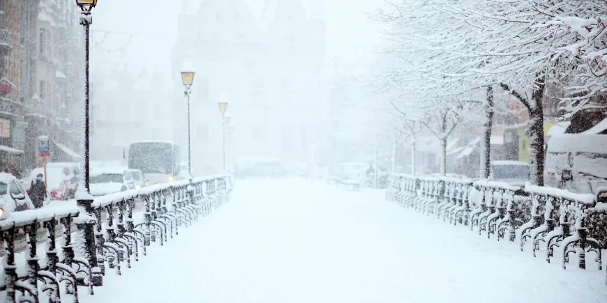
Yellow warnings for rain, snow and ice are in force across parts of Northern Ireland, Wales, southern and central England and the southern Pennines. Wet and wintry conditions have followed a recent northwest flow that pushed temperatures down and produced widespread frost in many northern and central areas.
Rain is moving in from the south and west and has already turned to snow over some hills. Northern regions are seeing a mix of wet and wintry precipitation, with persistent rain at low levels and snow over higher ground in several areas. Forecast guidance highlights the possibility of several centimetres of snow accumulating on high ground above typical hill elevations, with heavier totals signalled in parts of mid and southeast Wales and neighbouring counties. At low levels, sleet and wet snow are more likely, with a slushy mix possible at times.
Heavy rain may be concentrated in southern counties, where some locations could receive tens of millimetres in a short period, increasing the risk of flooding on ground already affected earlier in the season. Strong winds are also expected to form an additional hazard in exposed locations, with gusts flagged as a complicating factor for travel and coastal conditions.
Behind the headline
What led to the warnings is a cold air mass pushing across the country combined with frontal systems bringing moisture from the south and west. That setup is producing a banded pattern of rain, sleet and hill snow that will shift northwards through the period, bringing wintry hazards into new areas as it moves.
Key stakeholders include people travelling on roads and public transport, communities on higher ground, emergency responders, and utilities. Rural communities at higher elevation face the greatest exposure to heavy snow and the accompanying risk of becoming isolated. Transport operators and local authorities will be under pressure to manage stranded vehicles, clear routes and respond to any flooding or power interruptions.
Operational constraints include cold ground and frozen surfaces that increase the likelihood of ice after precipitation ends, and strong winds that may exacerbate flooding through waves on exposed coasts and create additional hazards for vehicles and structures.
What we still don’t know
- Exact accumulation amounts at specific lowland locations and the precise boundary between rain and snow at lower elevations.
- Which specific rural communities, if any, will become cut off and the likely duration of any isolation.
- Where and when any power or mobile service interruptions will occur, and how widespread they might be.
- Whether wind gusts will combine with precipitation to cause more significant coastal or inland impacts in particular counties.
- How warnings may evolve overnight as the system shifts and temperatures fluctuate.
What happens next
- Warnings persist or are escalated: If heavier rain or greater snow accumulations materialise than currently expected, agencies may raise warning levels and extend affected areas, increasing the likelihood of travel disruption and local flooding.
- Targeted travel disruption: Stranded vehicles and icy roads could produce delays and road closures, particularly on rural or high-elevation routes; this would be triggered by sustained snowfall at low levels or rapid freezing after rain.
- Localized power and communications impacts: Strong winds combined with heavy snow could cause isolated power cuts and mobile service loss in vulnerable communities; utility response times will influence duration of outages.
- Thaw then milder transition: As the system clears, many areas are expected to become drier and then see milder air move in, reducing snow depth but potentially creating runoff and short-term flood risk as snow melts.
- Ice hazard overnight: Following precipitation, falling temperatures may lead to significant ice formation on untreated surfaces, increasing slips, falls and road accidents unless treated promptly.
Why it matters
The immediate practical impacts are on mobility, safety and services. Commuters and travellers face a heightened risk of delays and cancellations on roads and public transport; emergency services may face increased call volumes. Flooding in the wettest locations could compound earlier saturated conditions, threatening property and infrastructure. For communities on higher ground, heavy snow raises the risk of temporary isolation and interrupted utilities. In the near term, the combination of precipitation and falling temperatures means that households and organisations should prepare for a period of disruptive weather and monitor updates for localised conditions.
Keep plans flexible, allow extra time for journeys, and follow local guidance on travel and safety until the system moves out and conditions stabilise.