


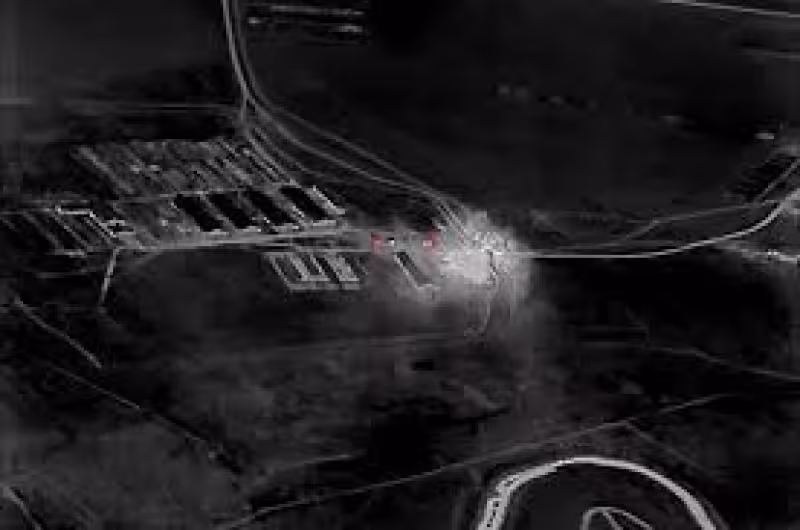
A Ukrainian unit about 10 kilometers from the front line in southeast Ukraine used near‑real‑time commercial satellite imagery to identify and then strike a Russian planning site, speeding and sharpening what the military calls drone warfare.
The unit launched a reconnaissance drone but the small aircraft could not see much through the trees. High‑definition, near‑real‑time images from commercial satellites were pushed directly to soldiers’ phones, tablets and laptops and showed thick, metal frames of armored vehicles parked around a building hidden by foliage. After three days of watching the site from orbit, the unit concluded it was a Russian meeting spot and followed with an attack drone strike.
The rapid delivery of geospatial intelligence shortened the time it takes to locate and strike Russian assets by as much as 90 percent, project participants say — the most tangible effect of a capability tested over the past six months. Military officials describe the deployment as the first known instance of unclassified, commercial satellite imagery going straight to a soldier’s device to guide real‑time battlefield decisions.
The imagery comes from a trans‑Atlantic collaboration: Colorado‑based Vantor supplied the satellite data, working with Dutch geospatial intelligence firm Bravo1Alpha, U.S. Persistent Systems and Ukrainian defense company Burevii to move images from orbit into the hands of frontline teams. The sensors deliver high‑resolution frames in near‑real time, meaning soldiers can confirm changes on the ground that a short reconnaissance flight cannot reveal.

That confirmation mattered during a springtime operation named Starfall II. Over 2½ weeks, a Ukrainian unit used the satellite feed to find and destroy what officials say amounted to billions of dollars in Russian assets. One target was an ammunition depot in occupied Ukraine identified when soldiers pulled a current satellite image of a compound that had been used to store grain before the invasion. Comparing the new picture with older photos convinced them the site had been repurposed for military storage and worth striking.
Putting commercial satellite imagery directly into a soldier’s pocket changes how units decide where and when to launch attack drones. Instead of relying solely on a short reconnaissance sortie that can be foiled by vegetation or limited flight paths, troops can interrogate multiple orbital snapshots, look for structural changes over time and make a strike decision without waiting for higher echelons to route intelligence through classified channels.
The technique has been tested in small‑team missions during the past six months and already delivered measurable battlefield returns in this spring’s operations. Still, the expansion question remains: the program’s use so far is described as limited to small teams and select missions, and there is no confirmed schedule for wider rollout across the Ukrainian military.
The capability arrived while the war is well into its fifth year and after Ukrainian forces emerged this spring with a tactical and technological advantage in several areas. The immediate gains — faster target identification and dramatically reduced time from detection to strike — have been proven in discrete operations. Whether the system will be scaled to change campaign‑level targeting, logistics and force posture outside those test missions is the unresolved point that will determine its strategic value.


