


weather los angeles: Evacuation Warnings Issued for Burn-Scar Areas as Winter Storm Threatens Flooding
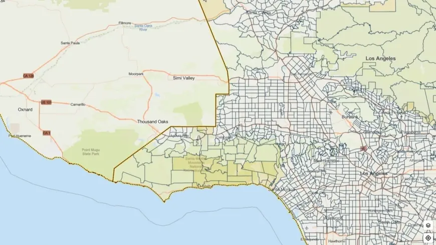
Los Angeles officials have issued evacuation warnings for neighborhoods near recent wildfire burn scars as a potent winter storm moves through Southern California, bringing heavy rain, thunderstorms and a heightened risk of flash flooding and debris flows. The flood watch spans Monday morning through Monday evening ET, and some evacuation warnings remain in place through 9 a. m. Tuesday ET.
Storm threats and expected impacts
Forecasters warn this system could produce intense rainfall rates—up to an inch per hour in some cells—along with strong winds and embedded thunderstorms capable of producing small tornadoes and gusts near 60 mph. The combination of heavy rain over steep terrain and recent fire burn scars increases the danger of debris flows, rock and mudslides that can strike with little notice.
Areas most at risk include slopes and canyons stripped of vegetation by last year’s wildfires. Those burn scars can funnel fast-moving flows of water, mud and rocks down drainages and into communities below. Officials emphasize that even brief, intense downpours can trigger life-threatening conditions in these vulnerable locations.
Evacuations, preparation and public safety steps
Evacuation warnings have been issued for select parcels near burn scars; residents in those areas are advised to be prepared to leave on short notice and to follow any evacuation orders if they are escalated. City and county teams — including emergency management, fire and public works personnel — are staging resources and coordinating outreach to protect the most vulnerable populations.
Local officials are activating measures to support people experiencing homelessness, including expanded outreach and motel voucher placements to provide shelter through the storm period. Emergency responders and public works crews are positioned to clear roads and respond to impacts, but residents are urged not to assume immediate access to assistance if conditions deteriorate rapidly.
What residents should do now:
- Make an evacuation plan for your household and identify a safe place to go if ordered to evacuate.
- Assemble an emergency kit with water, food, medications, important documents and a flashlight.
- Move vehicles to higher ground and avoid parking in washes, canyons or near steep slopes.
- Never drive through flooded roadways; just a few inches of moving water can sweep a car off the road.
- Secure outdoor items that could be blown away by strong gusts and clear gutters and drains where safe to do so.
- Stay tuned to official emergency alerts and local guidance for real-time evacuation orders and road closures.
Officials stress that evacuation warnings are not the same as mandatory orders, but they are issued to give households more time to prepare and act if conditions worsen. Those living below burn scars should treat a warning as an urgent prompt to ready evacuation plans and possessions.
With conditions expected to evolve rapidly, residents are advised to avoid unnecessary travel during the storm window. Even after the heaviest rain ends, secondary hazards such as unstable slopes and lingering debris flows can pose dangers for days.
Emergency agencies will continue to monitor the system and update response actions as needed. Residents in affected areas are encouraged to follow local emergency guidance, keep lines of communication open with neighbors and report immediate threats to emergency services.