The Climate Prediction Center expects El Niño to develop in the coming months and says the pattern is likely to ramp up as the summer approaches, a shift that will shape weather across large parts of the United States and the globe.
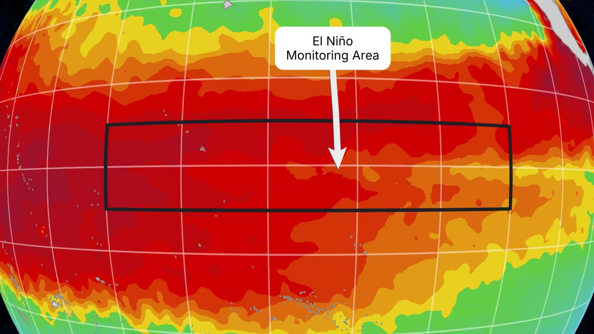
The forecast carries weight in two numbers: forecasters put the chance of a very strong, or "super El Niño," at about 37% as the early part of winter approaches, and a super event is defined by sea surface temperature anomalies in the monitored El Niño region exceeding 2 degrees Celsius. Since 1950, those anomalies have topped 2 degrees only three times; the most recent Super El Niño occurred in 2015-16. The last El Niño event before this one came in the winter of 2023-24.
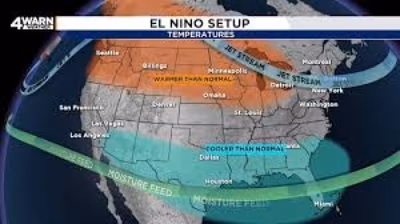
Those figures matter because El Niño is the warm phase of a fluctuating climate pattern along the equator in the tropical Pacific Ocean that tends to rearrange weather patterns around the world. In the United States, the pattern’s fingerprints are familiar: the southern United States tends to be wetter and sometimes cooler than average during El Niño, while parts of the Midwest, including Michigan, are more often drier and warmer than average.
The short-term forecast is also specific: forecasters said the summer would trend drier and warmer than average, a signal that lines up with the expected development of El Niño and with historical behavior during the warm phase of this Pacific cycle.
There is a friction point beneath the maps and probabilities. Strong El Niño events make certain outcomes more likely, but they do not guarantee them. The relationship between sea-surface anomalies and local impacts is noisy; a very warm monitored region raises odds for particular weather patterns but does not produce identical results every time. That gap between a clear ocean signal and uneven real-world effects is where forecasts are most vulnerable to surprise.


Complicating the picture further, emerging research suggests climate change is amplifying the swings of El Niño and La Niña by about 10%. That amplification does not change the mechanics of the oscillation; it increases the amplitude. In practical terms, a given El Niño could now push global average temperatures higher than the same event would have a generation ago.
That linkage helps explain another forecast detail: the expected El Niño could push 2026, and even more likely 2027, into the near-record category for average global temperature. Put simply, a developing El Niño arriving on top of a warmer baseline world raises the bar for annual temperature records.
For regions of the United States, the pattern being described translates into reasonably predictable tendencies. A drier, warmer summer is the expected trend for large swaths of the interior and Midwest, with the southern United States more prone to wet conditions and periodic cool spells relative to local averages. Those tendencies follow directly from El Niño’s influence on storm tracks and tropical convection, even as the precise distribution of rain and heat will vary from place to place.
The clearest tension going forward is probabilistic: models and forecasters agree that an El Niño is likely to develop and that the chance of a very strong event is substantial, but a substantial chance is not a certainty. Since 1950, sea surface temperature anomalies above 2 degrees Celsius have happened only three times, most recently in 2015-16, which keeps the super-El Niño outcome as notable rather than routine.
The best-supported conclusion is straightforward. The Climate Prediction Center’s signal—that El Niño will likely strengthen into the summer—raises the odds of a drier, warmer summer for parts of the United States and increases the likelihood that 2026, and especially 2027, will sit near the top of global temperature records. That is the practical frame for planners, forecasters and communities: odds have shifted, and those shifts matter in measurable ways for weather and climate this year and into the next.