


Gov. Abbott activates state emergency resources ahead of severe storms
Texas officials have moved state emergency response assets into standby as a powerful storm system moves across the state, threatening much of eastern Texas with severe thunderstorms, heavy rain, flash flooding, large hail, damaging winds and possible tornadoes. The threat is expected to begin later Friday and expand through the weekend.
State response mobilized
Governor Greg Abbott directed the Texas Division of Emergency Management to activate state-level emergency resources in anticipation of the storms. The governor urged residents to monitor road conditions before traveling, remain weather-aware, and have a plan in place in case of an emergency. Officials say multiple state resources are on standby to support local response efforts across affected areas.
Emergency management officials are also monitoring an elevated wildfire risk across parts of South, West and Northwest Texas as drier, windier conditions persist in some regions even as the storm system arrives. Texans were encouraged to assemble emergency supply kits and firm up family plans in case of sudden impacts.
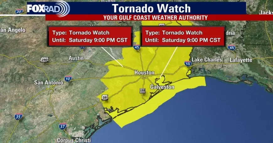
Storm threat, watches and local impacts
The National Weather Service warned that the system will first affect the Big Bend region and the Red River Valley later Friday and is expected to expand eastward over the weekend, eventually covering most of the eastern two-thirds of the state. Threats include embedded tornadoes, damaging straight-line winds, large hail and rapid-onset flooding where heavy rain falls in a short period.
In the Greater Houston area Saturday evening, a tornado watch that had been in effect was canceled for much of the metro area around 9: 00 p. m. ET, though some counties remained under watch longer. Earlier in the evening a tornado warning covered parts of Brazoria, Harris and Galveston counties from 7: 50 p. m. to 8: 15 p. m. ET, replacing a prior severe thunderstorm warning for the same corridor. Wind gusts up to about 60 mph were reported in spots, and damage was observed in portions of Pearland and Montgomery County.
Forecasters noted two particular areas of concern near Pearland and Rosharon as severe cells moved east at roughly 40 mph. The primary window for the strongest storms in the Houston region was expected to open around 6: 00 p. m. ET northwest of the city and sweep into the Gulf by about 11: 00 p. m. ET, though isolated storms can produce dangerous conditions outside that window.
What residents should do now
State and local officials urged residents to stay informed with the latest forecasts, follow guidance from local emergency managers, and be prepared to act quickly if warnings are issued. Recommended preparedness steps include identifying a safe shelter area in the home (an interior room on the lowest floor away from windows), assembling a multi-day supply kit with water and medications, and keeping a battery-powered radio or charged mobile device to receive alerts.
Motorists were cautioned to avoid travel if possible while storms are moving through, and to never drive through flooded roadways. If severe weather prompts sheltering, those in mobile homes or vulnerable structures should move to a sturdier building or designated shelter if time and conditions permit. Residents with property in high-wind or flood-prone areas should secure outdoor items and be ready to move vehicles and valuables to higher ground.
State leaders reiterated that rapid changes are possible with this system and urged Texans to remain weather-aware throughout the weekend and into next week while impacts shift across the region.