


Gov. Abbott Activates State Emergency Resources as Tornado Watch Spreads Across East Texas
Governor Greg Abbott has ordered state emergency response resources to be readied as a potent storm system moves across Texas, bringing a tornado watch and a risk of severe thunderstorms, heavy rain, large hail, damaging winds and localized flooding. Residents in many eastern and Gulf Coast counties were placed under a tornado watch and several locations saw tornado warnings Saturday evening.
State mobilizes emergency response ahead of weekend storms
The governor directed the Texas Division of Emergency Management to activate assets to support local response efforts as the threat expands through the weekend. "The State of Texas is prepared to respond to severe storms anticipated this weekend, " Abbott said. Officials also noted an elevated wildfire risk across portions of South, West and Northwest Texas into next week, underscoring the need for situational awareness across the state.
State emergency officials urged Texans to monitor road conditions before traveling, remain weather-aware and have a plan in place for emergencies. Residents were advised to assemble an emergency supply kit and follow guidance from local authorities as forecasts are updated.
Houston-area watches, warnings and impacts Saturday evening
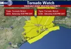
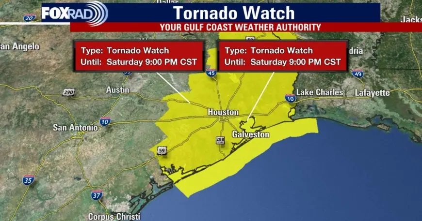
A tornado watch covered numerous counties in the Houston region and beyond through 10: 00 p. m. ET, with a partial clearance for much of the Greater Houston area later in the evening. Around 9: 00 p. m. ET the watch was lifted for a number of counties, while it remained in effect longer for certain coastal counties.
Earlier in the evening a tornado warning was issued for portions of Brazoria, Harris and Galveston counties from 7: 50–8: 15 p. m. ET. The warning replaced an earlier severe thunderstorm warning for the same corridor. Forecasters tracked a line of severe storms moving east at about 40 mph that was capable of producing both tornadoes and widespread straight-line wind damage.
Wind gusts up to 60 mph were reported in some areas, creating the potential for roof, siding and tree damage. Localized weather damage was noted in suburban areas south and northwest of Houston, and two primary areas of concern were highlighted near Pearland and Rosharon as storms swept through.
What residents should do now
Officials continue to urge residents to stay tuned to updated forecasts and to heed local emergency instructions. Key preparedness steps include identifying a safe shelter location, keeping a battery-powered radio or charged phone to receive weather alerts, and avoiding travel in heavy rain or flood-prone areas.
Those in the watch and warning areas should move to a small, windowless interior room on the lowest floor if a tornado warning is issued for their location. Motorists encountering heavy rain and strong winds are advised to pull off the road safely and avoid driving through flooded stretches.
State emergency teams are on standby to support local jurisdictions as needed. With the storm system expected to expand eastward through the weekend and cover much of the eastern two-thirds of the state, officials stressed the importance of preparedness and vigilance as conditions evolve.