


Snow storm this weekend: where the worst risks are, and why the biggest threat may be ice—not snow
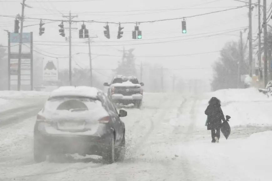
A major winter storm is set to disrupt large stretches of the United States this weekend (Saturday, January 24 through Sunday, January 25), with impacts lingering into Monday. The headline totals will come from heavy snowfall in parts of the interior and Northeast, but the higher-stakes danger sits farther south: a wide band of sleet and freezing rain that can turn roads into skating rinks, snap tree limbs, and knock out power. With conditions evolving hour to hour, the most important shift isn’t just how much falls—it’s where the rain-to-ice line sets up.
The uncertainty that changes everything: the “ice line” and rapid temperature swings
Snow is disruptive. Ice can be paralyzing.
Forecast confidence is highest that cold air and moisture will overlap across a broad corridor, but a small change in surface temperatures can flip the outcome from manageable snow to damaging glaze. That’s why the greatest operational risk is concentrated in areas that don’t see crippling ice often—where crews, drivers, and infrastructure are less accustomed to prolonged freezing rain.
Key hazards expected this weekend include:
-
Freezing rain and sleet across parts of the South and lower Midwest, where ice accumulation can lead to falling branches, downed lines, and extended outages.
-
Heavy snow from the southern Rockies through portions of the Mid-Atlantic and Northeast, creating difficult travel and potential whiteout bursts where winds increase.
-
A sharp drop behind the storm, bringing dangerous wind chills and refreezing on treated roads after plows pass.
Even if snowfall totals end up lower in some metro areas, a brief burst of heavy precipitation at the wrong time—overnight or during peak travel—can produce outsized impacts.
What’s happening this weekend: timing, travel strain, and early outages
The storm is already affecting parts of the central U.S., with snow and mixed precipitation spreading east and intensifying as the weekend progresses. The most disruptive phase is expected from late Saturday into Sunday, then shifting toward the Mid-Atlantic and Northeast as Sunday continues. Travel issues are expected to cascade: once aircraft and crews are out of position, delays can spread well beyond the heaviest bands.
Thousands of flights have already been canceled or delayed across the weekend period, and major hubs in the Southeast and along the East Coast are among the most sensitive points because even modest ice can slow ground operations. Road travel is also expected to deteriorate quickly where freezing rain falls ahead of the colder air—drivers may see “wet pavement” become black ice in minutes.
Power impacts are starting to show in some areas, with outages reported as ice and wind build stress on trees and lines. Utilities typically restore faster after snow than after widespread icing, especially if crews can’t safely reach damaged corridors.
Mini timeline (Jan 24–26)
-
Saturday (Jan 24): Mixed precipitation expands; road conditions worsen first where sleet/freezing rain arrives early.
-
Sunday (Jan 25): Peak disruption window for many regions; heavier snow bands push toward the Mid-Atlantic and Northeast while ice remains a major threat farther south.
-
Sunday night into Monday (Jan 26): Wraparound snow and bitter cold increase refreezing risk; cleanup and restoration may slow where ice damage is widespread.
The next few forecast updates that matter most are the ones that redraw the ice corridor and adjust how long subfreezing surface temperatures persist—those two factors will determine whether this weekend’s storm becomes a short-lived travel headache or a multi-day power and access problem for communities in its path.


