


Arctic Blast: Polar Vortex and Storm Threaten New England This Weekend
The current winter season is characterized by significant atmospheric shifts, particularly marked by the influx of Arctic air. This situation has created the potential for a substantial winter storm in various parts of the United States, particularly impacting regions from Texas to New England.
Arctic Blast: Polar Vortex and Storm Threaten New England This Weekend
The primary driver of these weather changes is the polar vortex, a strong jet stream that extends 5 to 7 miles above the Earth’s surface. This week, it is expected to push frigid air from Canada deep into the Southern and Central U.S.
Storm Forecast Across the Southern U.S.
- Expected Timing: Late Thursday into Friday
- Affected Areas: Northern Texas, Oklahoma, Arkansas, Missouri, Tennessee
- Weather Conditions: Widespread snow, sleet, and freezing rain
These conditions have the potential to disrupt travel and impact power grids across these states. Southern regions, including Mississippi, Alabama, Georgia, and the Carolinas, may face hazardous icing. This ice could create dangerous situations, including power outages and severe travel disruptions.
Potential for Severe Thunderstorms
In the southern sector of the storm, warm air may lead to severe thunderstorms, strong winds, and isolated tornadoes. The storm is expected to progress along the Eastern Seaboard through the weekend.
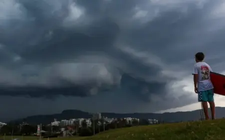
New England’s Impact from the Storm
Will New England be affected? Yes, but likely to a lesser degree compared to the southern states. While the storm’s core will move primarily to the south, areas like Boston could experience the storm’s northern edge. However, significant snowfall is not anticipated for most of the region.
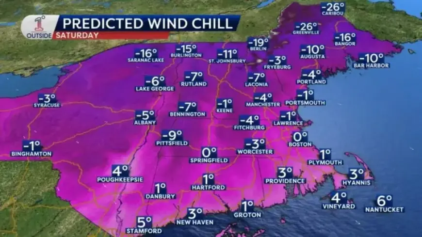
Frigid Arctic Air Arrival
- Friday Night: Wind chills expected to plummet below zero
- Saturday Temperatures: Daytime highs struggling to reach the low teens
- Wind Chill Values: Could feel like 10 to 25 degrees below zero
This weekend, the air will be bitterly cold. Wind gusts will contribute to a significantly lower “feels-like” temperature, particularly in northern New England.
Polar Vortex Dynamics
The polar vortex has shifted due to a recent stratospheric warming event, allowing cold Arctic air to move southward. This phenomenon is more pronounced this winter as a weak La Niña phase has made the weather patterns more unstable. Although high temperatures have been observed in some regions, the current cold spell is unusually intense for this time of year.
As the storm system unfolds, the exact snowfall totals for New England will depend on its trajectory. Monitoring storm updates will be essential for residents in the coming days.