


The National Weather Service issued a flood watch Sunday for the entire Rio Grande Valley, with the alert set to run from Monday afternoon through Wednesday morning. Forecasters expect heavy rain to build Monday and become more widespread Monday night into Tuesday, when the risk of flooding rises sharply across the region.
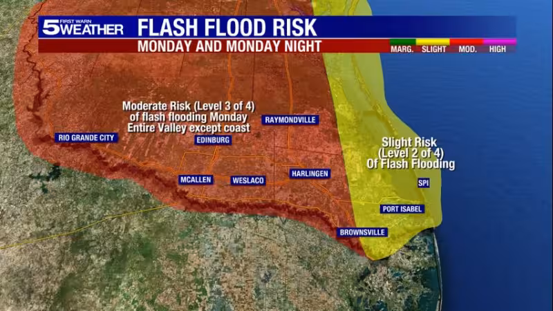
Rain totals of three to six inches are expected over the next three days, and isolated pockets could see eight inches or more. The Weather Prediction Center in Maryland put most of the Valley under a moderate risk of flash flooding for Monday and Monday night, which is Level 3 of 4 and means numerous flash floods are likely.

The eastern portion of the lower valley is the exception. It is under a slight risk, or Level 2 of 4, for Monday and Monday night, so the flood threat there is lower than in the rest of the Valley. Even so, the watch still covers the whole region, and the forecast leaves little room for comfort if the heavier bands of rain set up over the same area for long.
What is still unresolved is where the highest totals will fall. The forecast gives the Valley a broad warning, but it does not name the specific cities or counties most likely to take the brunt of the rain. That means residents across the Rio Grande Valley will be watching the timing closely as the heaviest rain is expected Monday night into Tuesday, while the flood watch remains in effect through Wednesday morning.


