


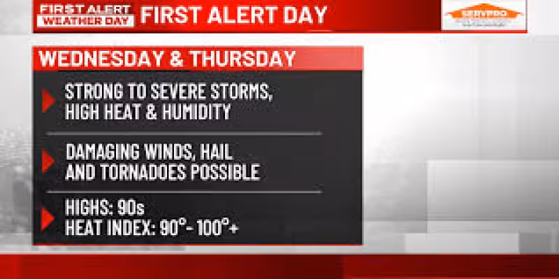
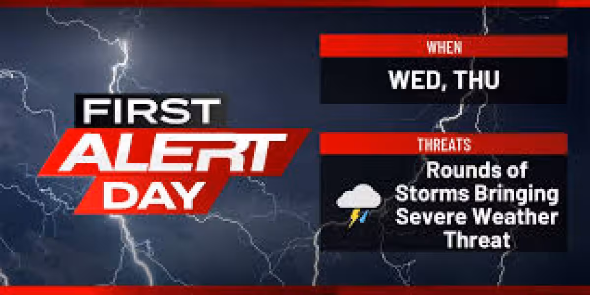
KWQC says the Quad Cities area faces two threats at once through Thursday: dangerous heat and multiple rounds of strong to severe storms. The station’s First Alert days run through Thursday as afternoon heat builds into the 80s and heat indexes climb to 90 to 100-plus.
Wednesday evening is the first window for trouble, with strong storms that could bring damaging wind and hail after an earlier round passes through. KWQC says more storms follow Thursday morning through Thursday evening, and the later rounds carry an added tornado risk.
The timing matters because the setup is not a one-shot burst. KWQC says a front will move through later Thursday and the final round of strong storms is expected when it arrives. Some models are getting that front through earlier, which could shorten the storm threat before mid-evening, but the exact timing is still uncertain.

That uncertainty leaves the viewing area in a narrow window where conditions can change quickly. First Alert days are reserved for inconvenient, hazardous or potentially dangerous weather in the Quad Cities, Iowa/Ill., viewing area, and June’s extreme humidity is helping push the heat index into the uncomfortable and potentially dangerous range.
KWQC says conditions improve Friday, with dry weather lasting through the weekend and less heat and humidity. Saturday could still bring a few thundershowers, but highs stay in the 80s. By Monday and Tuesday, temperatures may only reach the 70s, though another chance for rain remains in the forecast.
Erik Maitland urged viewers to “Stay informed and stay safe Wednesday evening and Thursday!” and described the period as “FIRST ALERT DAYS THROUGH THURSDAY FOR HEAT AND STORMS.” For now, the question is not whether the weather turns active, but how long the severe threat lasts before the front clears the area.


