


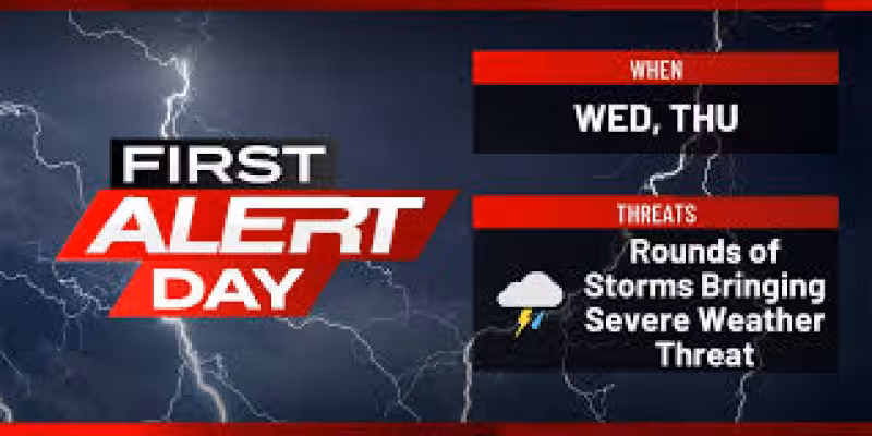
EASTERN IOWA — It will be a very active two days across eastern Iowa, and the region is under two First Alert Days in a row as strong to severe storms move through Wednesday and Thursday.
Damaging winds, large hail and tornadoes are all possible, with the tornado risk highest in individual storms and the damaging wind threat greater in lines of storms. The most important windows on Wednesday are the morning, from about 10 a.m. to 1 p.m., and then again later in the afternoon and evening as a frontal boundary moves into the area. Storms could form in scattered fashion during the morning, and if they organize within a few hours of developing, they could become strong to severe quickly. Another round is likely ahead of the front, especially near and after 3 p.m. to 4 p.m., and activity should start pushing out by late evening.
Thursday brings another First Alert Day, and the Storm Prediction Center keeps most of eastern Iowa in an enhanced risk, with a slight risk outside that area. A cluster or line of storms is expected in the morning after developing overnight in Nebraska and western Iowa, with damaging winds the main threat, though hail and an isolated tornado are also possible. What happens after that depends on how much energy the morning round uses up. If the atmosphere has a chance to recover, more storms are likely Thursday afternoon, when all severe hazards could be in play from late morning into the evening.
Heavy rain is another concern. Over the next few days, 1 to 2 inches of new rainfall is quite possible, with isolated higher totals and some isolated flash flooding. River flooding is unlikely for now because river levels are generally running low. The sharpest uncertainty is not whether storms will come, but how severe they become in specific locations, especially on Thursday after the morning round either weakens or clears the way for renewed afternoon development. People across eastern Iowa should stay weather aware and keep checking updates through Thursday.


