


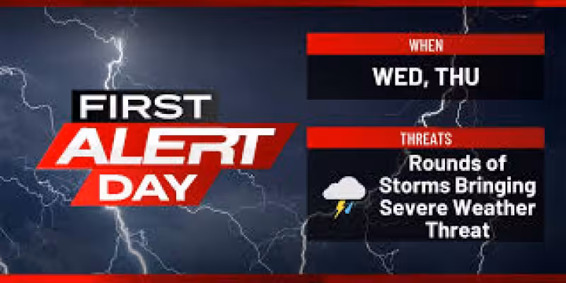
KCRG says eastern Iowa is headed into a very active stretch, with strong to severe storms possible Wednesday and again Thursday during two First Alert Days in a row. The main threats are damaging winds, large hail and tornadoes, with the highest tornado risk in individual storms and the stronger wind threat more likely in lines of storms.
On Wednesday, the first round could arrive in the morning between about 10 a.m. and 1 p.m., developing in a scattered fashion before the main action shifts toward the afternoon and evening. A second round is expected as a frontal boundary moves into the area, with storm development likely near and after 3 p.m. to 4 p.m. That timing matters because any early storms may help reduce some uncertainty for later ones, but residents should not let their guard down if the morning stays quiet or only a few storms pass through.
Thursday brings another First Alert Day, and the Storm Prediction Center has most of the area in an enhanced risk again, with a slight risk outside that zone. A cluster or line of storms is expected to form overnight in Nebraska and western Iowa and move east by Thursday morning. Damaging winds are the main concern then, though hail and an isolated tornado are also possible. If the atmosphere recovers after that first round, more storms are likely Thursday afternoon and evening, when all severe-weather hazards could return.
The rain could add up, too. Totals of 1 to 2 inches are possible over the next few days, with isolated higher amounts and the chance for isolated flash flooding. River flooding looks unlikely because river levels are generally running low across the area, but the forecast still points to two consecutive days of unsettled weather and several windows where storms could turn severe fast.
What comes next depends on how the morning rounds evolve Wednesday and Thursday. Those early storms could change the later forecast, but they are not expected to eliminate the threat. For eastern Iowa, the main takeaway is simple: the severe-weather risk stretches across two days, and the strongest storms could come in more than one wave.


