


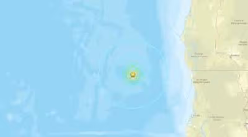
An earthquake today registered at magnitude 5.1 struck in the North Pacific Ocean roughly 40 miles west of Petrolia, California, at 5:45 a.m. Pacific time, the United States Geological Survey reported.
The 5.1 reading prompted the U.S. seismic agency to publish updated shake-severity mapping and begin targeted aftershock monitoring for the area. Subsequent quakes were reported in the same vicinity after the first event, and USGS scientists marked the region for continued observation.
As of Wednesday, June 3 at 6:03 a.m. Pacific time, shake data for the initial event was current; by Thursday, June 4 at 9:45 a.m. Pacific time, aftershock reports had been collected and cataloged. When aftershock data is available, the corresponding maps and charts commonly include earthquakes within 100 miles and seven days of the initial slip, a range the agency is using while it refines its public products.
Seismologists have warned that the initial 5.1 magnitude could be revised as additional recordings and analyses arrive. The network that first estimated the event pulls more distant and higher-resolution station data into its models over hours and days; those inputs sometimes shift an early magnitude up or down once the full dataset is processed.


Officials emphasized monitoring rather than immediate public-action orders. The updated shake maps help emergency managers and scientists see where shaking was strongest and where aftershocks are most likely to occur. Because aftershocks are the result of minor adjustments on the portion of a fault that slipped in the main event, the pattern and size of follow-ups can vary; aftershocks can occur days, weeks or even years after the first earthquake.
For residents tracking recent regional activity, this event follows other small tremors reported in different parts of the country; for local context, see Earthquake Today Columbia Sc: 1.9 Tremor Detected North of Irmo —
The immediate consequence is a focused monitoring effort: seismologists are cataloging every subsequent shock in the area and USGS staff may update the shake-severity map as new station readings change the picture. That map revision is the practical next step for scientists working to calibrate alerts and public guidance.
The central unresolved question left by the early reports is whether the measured magnitude will change and how large any aftershocks will be. Both answers depend on incoming seismic data and model revisions over the coming hours and days; those updates will determine whether the event remains a moderate offshore quake with limited local impact or whether adjustments alter the record of shaking for coastal communities.


