
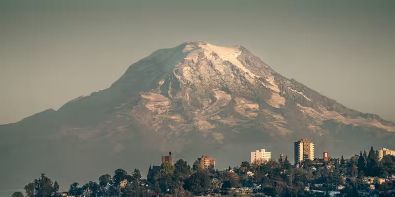
Scientists say Mount Rainier can produce no-notice lahars — fast, destructive flows of water, rock and sediment — that could reach Orting, Puyallup and Sumner in roughly 30 minutes without any eruption.
A lahar is a slurry of sediment, rocky debris and water that starts on a volcano and travels downslope very quickly; researchers warn these flows can devastate towns in a matter of minutes. Models and field studies for Rainier place more than 60,000 residents in towns on the mountain’s western flank squarely in the projected path, and roughly 150,000 people live inside Pierce County where lahar channels run.

The immediate triggers for a no-notice lahar do not require molten rock. A landslide beginning on the western side of Rainier could demolish Orting, Puyallup and Sumner in about half an hour. Sudden failures of glacial or volcanic dams and intense thunderstorms can set the same process in motion: a steep slide entrains ice, water and loose sediment, turning into a high-speed flow that follows river valleys straight into populated lowlands.
Experts point to the scale of the risk and the short arrival time to explain growing concern. The United States Geological Survey has deemed lahars the most threatening hazard in the Cascade Range; Mount Rainier’s proximity to dense communities magnifies that threat. One local observer captured the unease plainly: "[No-notice lahars are] the thing that goes bump in the night," and, he added, "It creeps me out."


Scientists stress that lahars are not uniform. "They are complex phenomena that change a lot during transport," said Lizeth Caballero García, noting their behavior can shift as flows pick up or shed material. "They can grow, they can dilute." To better understand those changes, researchers built a custom flume in Oregon’s H.J. Andrews Experimental Forest that can replicate lahar-like flows under controlled conditions, supplying data to refine speed and volume estimates.
Monitoring has expanded since the 1980 Mount St. Helens eruption, an event that shifted volcanic science toward hazards beyond explosive eruptions. The Cascades Volcano Observatory has created an extensive network of monitors across the Cascade Range to detect lahars and other volcanic activity, and decades of field study feed the evacuation planning used by emergency managers in Pierce County and nearby towns.
There is, however, a critical contrast in current assessments: the lahar scenarios scientists describe do not depend on an impending eruption. Experts emphasize there is no evidence Mount Rainier is about to erupt, yet lack of eruptive activity does not eliminate the lahar hazard because non-eruptive triggers can launch dangerous flows with little or no warning.
The practical consequence is stark. Even with improved sensors and experimental research, the time between a trigger high on Rainier and impact in downstream towns can be measured in tens of minutes. Early-warning systems and evacuation plans aim to close that window, but the physical mechanics — steep slopes, ice, water and loose sediment — mean rapid onset is a defining feature of the threat.
The single unresolved question is timing: when, if ever, will Mount Rainier produce a no-notice lahar that matches the catastrophic scenarios planners prepare for? Scientists will keep refining detection networks, running flume experiments and updating flow maps to narrow uncertainty, but predicting which slope failures will occur and when they will cascade into a town remains beyond current capability. Preparing for an event that can begin without an eruption therefore remains the central challenge for officials and communities in Rainier’s shadow.