


“Storm Pedro: Snow and Ice Forecast Across UK This Week”
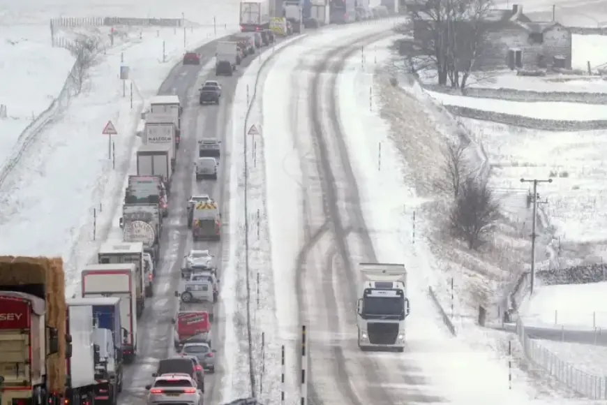
The UK is preparing for a cold and wintry week as Storm Pedro approaches. This storm is expected to bring significant rain, ice, and snow nationwide. Met Office has issued yellow weather warnings for ice and snow that will affect much of Wales, along with central and southern England, starting Wednesday afternoon and lasting into Thursday morning.
Weather Warnings and Forecasts
Warnings for rain are also in effect for the south coast from 6:00 AM on Wednesday to 8:00 AM on Thursday. Coastal areas will suffer from heavy downpours, contributing to potential flooding and travel disruptions.
- Rainfall Estimates:
- 10-20 mm expected across much of the affected areas.
- Up to 30 mm in some southern coastal regions.
- Dartmoor, Devon may experience as much as 50 mm.
Snow Accumulation Predictions
Forecasters indicate the possibility of significant snow accumulation, primarily in hilly regions. The expected accumulation includes:
- 2-5 cm above elevations of 150-200 meters.
- 10-15 cm above 250-300 meters in parts of Wales and the southern Pennines.
- Minor accumulations of less than 2 cm at lower elevations overnight.
Impact of Icy Conditions
Icy conditions could lead to hazards in parts of Wales and southwest England, increasing the risk of slips and falls on untreated surfaces. Flooding has already affected many locations in Britain this year, with Storm Chandra causing significant disruptions last month.
Health and Safety Advisories
The UK Health Security Agency has issued cold weather alerts across multiple regions, effective from 6:00 PM on Tuesday to 6:00 PM on Friday. These alerts highlight the increased risk to vulnerable populations, potentially leading to a greater demand on healthcare services.
Extended Weather Outlook
The yellow weather warning for snow will cover sections of Wales and western England, including key cities like Birmingham and Worcester from 4:00 PM on Wednesday until 6:00 AM on Thursday. Additionally, rain warnings span from Kent to Cornwall during the same timeframe.
Deputy chief forecaster Steven Keates noted that initial snowfall may occur over the highest areas of southern England. However, the majority of snow activity will focus on the higher elevations in the Midlands and mid-southeast Wales.
As temperatures fluctuate, overnight frost is expected in parts of Scotland, with additional frost forecasted for Thursday. By the weekend, a shift in conditions will bring milder temperatures, potentially reaching the low-to-mid teens in sunny areas, despite the prediction of further wind and rain.