


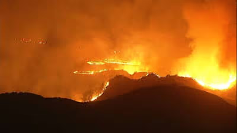
A wildfire burning through Riverside County east of Los Angeles grew to about 3 square miles, or 8 square kilometers, as flames pushed through the night in southern California and left more than 2,000 acres burned.
Evacuation orders were issued in parts of the county, and shelters were set up for displaced residents as officials moved to keep pace with a fast-moving blaze that was still active on Monday.
The California Department of Forestry and Fire Protection said more than 250 personnel and more than 40 fire engines had been deployed to tackle the fire. Aerial footage filmed Monday showed a helicopter trying to douse the flames above the burn area.
Even as orders were issued, vehicles were still driving on roads that appeared to be close to the fire, a sign that the danger had not yet fully caught up with movement on the ground. The cause of the wildfire was not immediately reported, and officials had not said whether it had been contained.
For now, the fire map across Riverside County points to an emergency still unfolding rather than one already settled. The next update that matters is whether crews can stop the spread before the acreage climbs again.


