


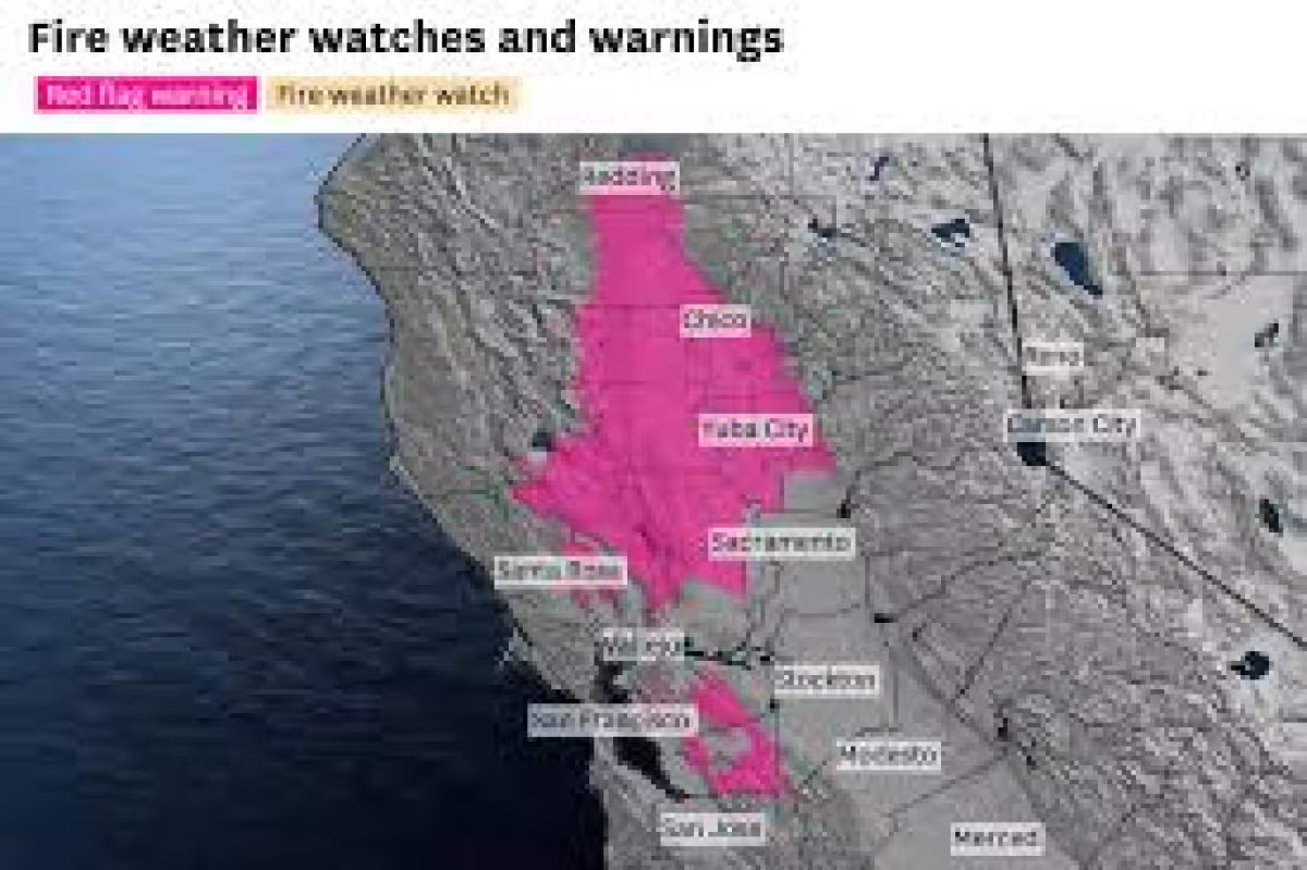
North Carolina is heading into several days of aviso de calor, with temperatures expected to climb near 100 degrees and heat index values as high as 104 or 105 degrees by Thursday and Friday. Much of the state will sit under a warm, humid air mass for the rest of the week, and the hottest stretch is expected to land in the Piedmont Triad, including Winston-Salem, Greensboro and High Point.
The heat matters because the National Weather Service says the risk of heat exhaustion and heat stroke rises once the heat index goes above 100 degrees. For people working outdoors, exercising or spending long periods outside, the danger will come not just from the thermometer but from the muggy air that makes it feel several degrees hotter than the actual temperature.
Thursday and Friday are likely to be the toughest days. Temperatures could reach between 97 and 99 degrees, and the humidity could push the apparent temperature into the 104 to 105 degree range. That is the window when the state’s most intense heat is expected to settle in before gradually easing during the next week, when temperatures could fall back into the 80s.

North Carolina is also likely to see the kind of afternoon and early evening storms that often build in summer heat. Some spots could be hit by heavy rain for a few minutes while nearby communities stay dry, a reminder that these storms can be highly localized. They are expected to form from heat accumulated during the day and usually fade after sunset.
That split pattern is typical for the season, but it still leaves a narrow and important margin for safety. A short downpour can cool one neighborhood while another remains under dangerous heat, and the combination can catch people off guard if they are relying on rain to bring relief. The bigger change now is not immediate cooling, but the slow weakening of the heat wave into next week.
For now, the clearest answer is that North Carolina will stay hot, humid and unsettled through the end of the week, with the strongest heat centered on Thursday and Friday. The open question is whether any part of the state will receive official heat alerts or advisories before the pattern starts to break.


