


Portland is heading into its first heatwave of 2026, with temperatures expected to climb sharply this weekend and peak Sunday and Monday. After a rainy June day on Monday, the city could move from scattered Tuesday showers to highs near 90 degrees by Saturday and possibly the upper 90s, or even 100, at Portland International Airport.
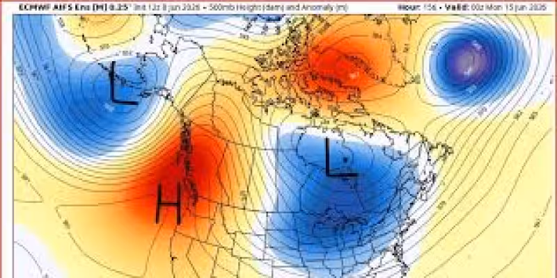
The warmup is being driven by a big ridge of high pressure building just offshore over the weekend and lingering into next Tuesday, along with very warm air aloft and east winds down the Cascades. In Portland, forecasters usually define a heatwave as three days at or above 90 degrees, or at least one day at 95 or higher, and this one appears likely to meet that mark even if it is not expected to be a long-lasting or historic event.
The weather shift will feel abrupt. An upper-level low moved across the region Monday afternoon and brought a rainy June day, but most places west of the Cascades were expected to get less than 1 inch of rain and many less than half an inch before showers taper off Tuesday night. By late Saturday through late Monday, afternoon temperatures could run about 40 degrees warmer than they were just 6 to 7 days earlier.

Sunday looks like the most consequential day. Forecasts say it could blow through the last remaining sub-90-degree June daily temperature record, with a predicted high of 98 degrees on June 14, nine degrees above the previous mark. Portland-area forecasters also said the city could possibly reach 100 degrees at PDX, and National Weather Service guidance put the chance of 100-degree heat on Sunday and Monday between 20% and 40%.
That uncertainty is the hard part of the forecast. Most model runs still point to a major hot spell, but the difference between 96 degrees and 100 degrees matters for record books, cooling plans and how much relief residents will need to find during the hottest stretch. One forecaster said, “It’s not out of the question to see some daytime highs of 100, maybe even 101,” and added that people should check on neighbors, friends and family and give them a heads-up.
The pattern should ease after Monday, but not before Portland gets its first real blast of summer heat. For now, the only open question that matters is whether the city tops out in the upper 90s or crosses the 100-degree line at PDX.


