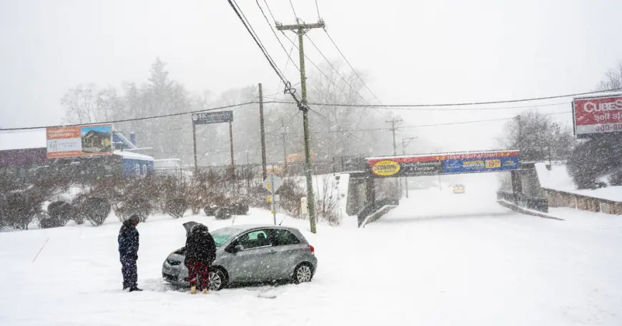
Blizzard warning NYC issued as powerful Sunday–Monday storm targets the metro

A blizzard warning NYC is now in place as a rapidly strengthening coastal winter storm is set to bring heavy snow, damaging wind gusts, and near-zero visibility at times from Sunday, February 22, 2026, into Monday, February 23 (ET). The combination of intense snowfall and strong winds is expected to create dangerous travel conditions across New York City and nearby parts of New Jersey, Long Island, and southern Connecticut.
Blizzard warning NYC: timing and what it means
The blizzard headline reflects a high confidence risk of whiteout conditions driven by falling and blowing snow, not just the amount of snow on the ground. For much of the metro, the broader winter storm window begins early Sunday, while the most severe conditions are expected to ramp up later Sunday and persist into Monday.
Key storm timing (ET):
| Period | What to expect |
|---|---|
| Sunday morning | Snow begins or increases; conditions still variable by neighborhood |
| Sunday afternoon–night | Heavier bands develop; winds strengthen; visibility drops quickly |
| Monday morning–afternoon | Peak impacts linger; blowing snow and tough travel continue |
| Monday evening | Gradual improvement, though cleanup and disruptions continue |
Winter storm warning and watch updates around the region
Alerts across the metro include both winter storm warnings and, in some nearby areas earlier in the cycle, winter storm watches as confidence increased. A watch signals the potential for high-impact winter weather; a warning signals that significant impacts are expected.
In practical terms: if you’re in the NYC area, plan for a high-impact storm regardless of the exact label on your map—especially during the Sunday night and Monday commute windows.
How much snow on Sunday, and storm totals for NYC snow
For people asking how much snow on Sunday, the most likely pattern is lighter accumulation during the day, followed by a sharper jump in snowfall rates later Sunday as the storm intensifies. The “headline totals” are more likely to be reached through a long-duration event that peaks Sunday night into Monday.
Current projections for nyc snow generally cluster around 13–17 inches for much of the city, with localized higher totals where persistent heavy bands set up. Areas closer to the coast, especially parts of Long Island and exposed shore communities, have a higher chance of reaching 15–20 inches.
Snowfall rates could be high enough at times to overwhelm plowing and treatment, meaning roads can deteriorate quickly even after crews pass.
Blizzard conditions, wind, and coastal flooding risks
This storm is not only about snow depth. Winds are expected to be a major driver of impact, with gusts in the strongest corridor reaching around 50–60 mph. That’s strong enough to:
-
Blow snow back onto cleared roads
-
Snap weakened branches and down isolated power lines
-
Create rapid visibility collapses in heavy bands
Coastal flooding is also a concern, particularly in low-lying and shoreline areas, with the most sensitive window typically aligning with high tides Sunday night into Monday morning (ET). Even moderate flooding can complicate emergency response and strand vehicles in vulnerable waterfront zones.
NYC travel, NJ weather impacts, and what to expect Monday
For new york weather and nj weather impacts, the biggest issue is timing: the storm is projected to peak when many people are either traveling Sunday night or attempting to get to work and school Monday morning.
Expect:
-
Major slowdowns on untreated or windswept roads
-
Reduced visibility on bridges and open highways
-
Increased risk of flight delays and cancellations
-
Transit disruptions and longer waits, especially on surface routes
If you must travel, the safest choice is generally earlier Sunday before the most intense combination of wind and heavy snow arrives.
What to do before conditions deteriorate
With a snow storm nyc scenario like this, small prep steps make a real difference:
-
Charge phones and backup batteries; keep a flashlight accessible
-
Bring in loose outdoor items that can become wind hazards
-
Stock essentials for 24–36 hours (meds, food, pet needs)
-
Avoid parking in low-lying coastal areas if flooding is possible
-
If you rely on buses, plan for longer waits and potential reroutes
The main message: treat Sunday night through Monday afternoon as a period when travel may be very difficult to impossible, even if snowfall totals vary by neighborhood.
What happens after the storm
A milder air push later in the week may accelerate melting, which can create messy follow-on hazards: slush, refreeze, and clogged storm drains. After the snow ends, continued gusts can keep blowing snow across roads and sidewalks, prolonging poor visibility and drifting in exposed areas.
For the latest neighborhood-level changes, focus on official weather alerts and local emergency updates, especially if your plans depend on Monday morning conditions.


