


weather los angeles: Evacuation Warnings for Burn Scar Areas as Powerful Winter Storm Approaches
City and county officials have issued evacuation warnings for neighborhoods below recent wildfire burn scars as a major winter storm moves into the region. The system is expected to produce heavy rain, strong winds and isolated severe weather from Monday morning through Monday evening ET, with some warnings remaining in place into Tuesday morning ET.
Storm timeline and primary hazards
Forecasters forecast a wide swath of heavy rain and thunderstorms beginning Monday morning and continuing into the evening hours ET. Meteorological guidance indicates localized intense downpours—at rates approaching one inch per hour in some cells—along with the potential for strong gusts near 60 mph and isolated rotating storms.
The biggest immediate concern is the heightened risk of rapid runoff on steep slopes and recently burned ground. Burn scars lack the vegetation and soil structure that normally absorb rainfall, making them especially vulnerable to fast-moving mud and debris flows. Rockslides and shallow landslides are also a significant threat where terrain is steep and soils are saturated.
Evacuation warnings and local response
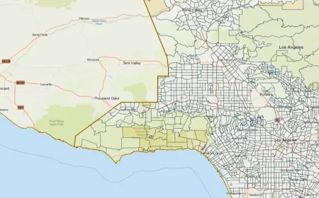
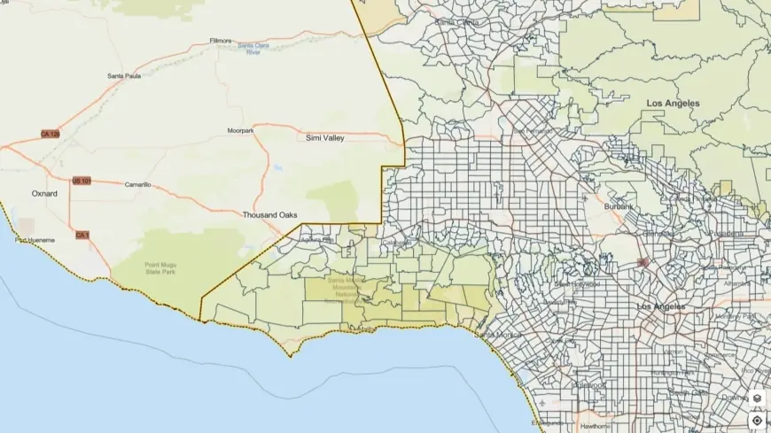
Evacuation warnings have been posted for select parcels adjacent to areas that burned in recent wildfires; those warnings remain active through 9 a. m. Tuesday ET in affected zones. Officials urge residents in those flagged neighborhoods to prepare to leave immediately if an evacuation order is issued. An interactive map showing the warnings and alerts has been made available by local authorities for residents to check their status.
City leadership emphasized that first responders and public works crews are mobilized ahead of the storm to clear drains, stage equipment and stand ready to assist with emergency response. Special outreach efforts are underway to assist residents experiencing homelessness and others who may be particularly vulnerable; temporary shelter options and motel vouchers are being readied to expand available placements during the storm period.
What residents should do now
Residents in and around burn scar areas should take immediate preparedness steps: pack an evacuation kit with essential documents, medications, water and food; identify multiple evacuation routes; and move vehicles off streets prone to flooding. Avoid travel during heavy downpours and never attempt to drive through flooded roadways or moving water.
Those living near steep terrain or washes should remain especially vigilant. If you notice rising water, unusual cracking in soil, or sudden changes in creek or channel flow, evacuate to higher ground without delay. Keep mobile devices charged, follow official alerts local emergency notification channels, and be ready to follow evacuation orders if they are issued for your area.
Emergency personnel will be monitoring conditions throughout the event and will issue additional guidance as the situation evolves. Residents are encouraged to stay informed through local emergency channels and to heed directions from law enforcement and emergency management officials for their safety.
As the storm approaches, expect rapidly changing conditions and treat all flood-prone roadways and burn scar zones with heightened caution through Monday night and into Tuesday morning ET.