


Tornado watch prompts state emergency activation as severe storms sweep across Texas
State officials activated emergency response resources and issued widespread weather alerts as a powerful storm system moved across Texas, bringing heavy rain, damaging winds, large hail and the potential for tornadoes. Residents in many eastern and coastal counties were placed under a tornado watch and multiple tornado warnings were issued Saturday evening.
State mobilizes resources as storm threat expands
Governor Greg Abbott directed the Texas Division of Emergency Management to put state assets on standby ahead of the severe weather outbreak. The move positions emergency crews and equipment for rapid deployment as needed, and officials emphasized the importance of monitoring road conditions, maintaining situational awareness and having an emergency plan in place.
Emergency managers also flagged an elevated wildfire risk across parts of South, West and Northwest Texas into next week, underscoring the complex hazards tied to the overall weather pattern. Residents were advised to assemble basic supply kits, identify safe shelter locations and heed local official guidance for evacuation or sheltering if conditions deteriorate.
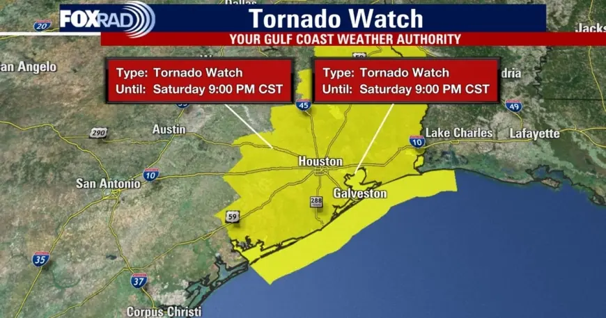
Watches, warnings and reported impacts in the Houston area
Forecasters placed many eastern Texas counties under a tornado watch that extended into the evening hours. Around 8: 00 p. m. ET, the tornado watch was canceled for much of the Greater Houston area; it remained in effect until 9: 00 p. m. ET for Chambers and Galveston counties. Earlier, a tornado warning was issued for parts of Brazoria, Harris and Galveston counties from 6: 50 p. m. ET to 7: 15 p. m. ET.
Meteorologists tracked a line of severe storms moving east at roughly 40 mph with two areas of particular concern near Pearland and Rosharon. Wind gusts up to 60 mph were reported in some locations, creating the potential for roof, siding and tree damage. Weather-related damage was observed in Pearland and portions of Montgomery County during Saturday evening storms.
The outlook identified a heightened window for strong to severe activity beginning around 5: 00 p. m. ET northwest of Houston and sweeping into the Gulf by about 10: 00 p. m. ET. The region was placed under an elevated severe-weather risk, described as 2 out of 5 on the local threat scale, meaning damaging wind gusts, heavy rain, small hail and isolated tornadoes were possible.
What residents should do now
State and local officials urged Texans to stay informed, monitor the latest forecasts and follow guidance from emergency management and public-safety authorities. Practical steps to reduce risk include identifying an interior, windowless room for shelter, securing loose outdoor items, and avoiding travel while severe storms are ongoing.
Motorists should check road conditions before heading out and avoid flooded roadways. If a tornado warning is issued for your area, take shelter immediately in a sturdy structure; if you are outdoors or in a vehicle, move to the closest substantial shelter or low-lying area while protecting your head.
Officials reiterated standard preparedness actions: create a family emergency plan, assemble a supply kit with water, food, medications and flashlights, and ensure communication plans are in place for loved ones. With the storm system expected to affect much of eastern Texas through the weekend, residents are urged to remain weather-aware and ready to respond to changing conditions.
State emergency resources remain on standby to support local response efforts as needed while crews continue to assess damage in impacted communities.