


“4Warn Weather Alert Issued for Metro Detroit: What to Expect Friday”
A 4Warn Weather Alert has been issued for Metro Detroit due to an impending winter storm. This alert is significant as it indicates challenging weather conditions for residents in Southeast Michigan.
Details of the Weather Alert
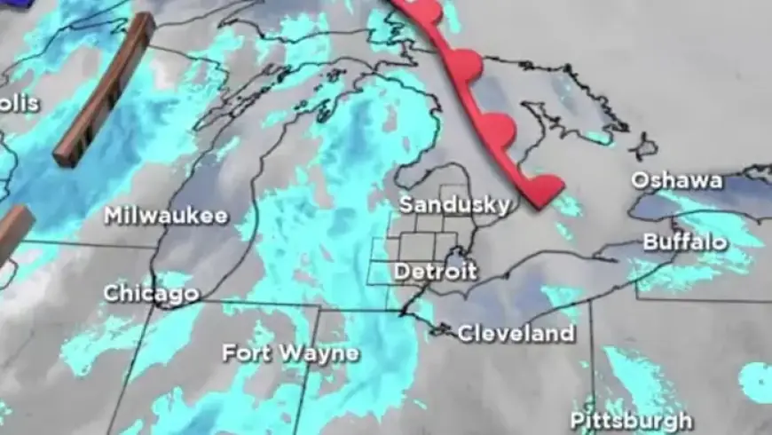
Snow is forecasted to begin Friday morning. Light accumulation is expected by the end of the morning commute, with more consistent snowfall in the afternoon. Most areas in Metro Detroit could see between 1 to 3 inches of snow, while the Thumb region may experience isolated totals close to 4 inches.
Reasons for the Alert
- Accumulated snow from a previous winter storm has left many roads icy.
- Snow falling during peak commute times can create hazardous conditions.
- Even minimal new snowfall can result in slippery surfaces, compounding existing issues.
The alert is intended to prepare residents for potentially difficult travel conditions and to emphasize the importance of safety during their travels.
Forecast by Region
Temperatures will vary significantly across Southeast Michigan on Friday. In the morning, readings are likely to be in the teens, with wind chills reaching single digits. High temperatures in Metro Detroit are expected to be in the lower 30s, while the Thumb region will remain cooler, with highs in the upper 20s.
As the day progresses, the snow may turn wet and slushy, especially near Detroit, tapering off by 5 p.m. A few light snow showers might persist in the evening. However, as temperatures drop overnight, slush could refreeze, leading to icy patches on side streets, bridges, and sidewalks.
Impact on the Weekend
Weekend travel could be affected by continued cold temperatures and the potential for additional snow. Key dates include:
- Saturday, Jan. 17: Expect highs in the upper 20s in Metro Detroit and lower to mid-20s in the Thumb, with scattered snow showers.
- Sunday: Highs will remain in the lower 20s with wind chills possibly dipping into the single digits.
- Martin Luther King Jr. Day: Extremely cold air will arrive, with highs potentially only in the teens and sub-zero wind chills expected in some areas.
Further light snowfall is possible late Sunday into Monday. Residents are advised to exercise caution on untreated roads and be prepared for quickly changing conditions.
Safety Reminders
Travelers should plan for extra travel time and remain vigilant of the road conditions throughout the weekend. The impact of snow and ice is most pronounced on side streets and untreated roads. Share your snow experiences with your local community to keep everyone informed.


