


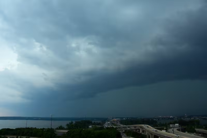
Yes — rain had reached the Washington area by around 6 p.m. Sunday, and by evening severe thunderstorms were moving through the D.C. region with the threat of heavy rain and damaging winds. A severe thunderstorm watch remained in effect until 11 p.m. as the storms advanced eastward.
The first band of storms may produce damaging winds, large hail, torrential rain and isolated tornadoes, and the threat was expected to last through at least 10 p.m. Mike Stinneford said the storms would likely end by midnight, after moving through Southern Maryland by 7:30 p.m. and hovering over Prince William County with wind speeds clocked between 40 mph and 50 mph as of 8:15 p.m.

That shift came after most of Sunday stayed sunny and hot, with temperatures climbing into the lower to mid-90s before the atmosphere destabilized enough for scattered thunderstorms to break out. For people in Washington, that meant a wet and potentially dangerous evening after a dry, sweltering start to the day.
The timing also mattered for anyone out late in the city, including attendees at a UFC event in Washington, because the storms were expected to remain active well past sunset. Once the line moved through, conditions were forecast to turn partly to mostly sunny on Monday, with cooler, less humid weather and highs of 80 to 85. The question for the rest of the night was not whether rain had arrived, but how much more would fall before the line finally exited just before midnight.


