


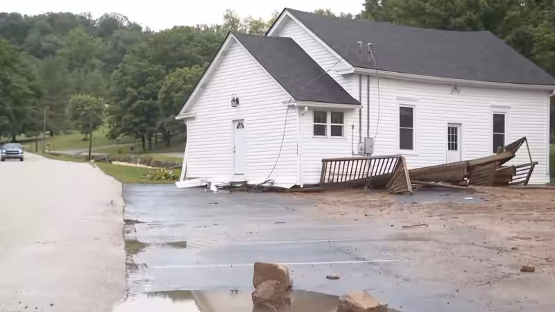
Flash flood warnings were in effect Tuesday for parts of Kentucky and Indiana after Lanesville, Indiana, recorded 8 inches of rain in a matter of hours, sending rescue crews in boats into multiple counties and leaving some people stranded on roofs in Indiana.
The flooding reached central Kentucky as well, where Lexington had already seen multiple flooded roadways by Tuesday afternoon. Fire and police were called to an earlier report of a submerged vehicle at the end of Byrd Thurman Drive, and no one was found inside. The entrance to Maple Grove Mobile Home Park off Georgetown Road was flooded, while in Scott County, Leestown Road near the Fayette County line was covered in water. Midway Mayor Grayson Vandegrift said Dudley Street was closed because of high water.
Even with that damage, no water rescues had been reported in the counties surrounding Lexington, a sharp contrast with the situation in Indiana, where crews were answering boat calls as reports came in of people trapped by flood waters. The gap matters because it shows how quickly conditions can turn from nuisance flooding to a rescue operation, even within the same storm system.
The warnings covered a broad stretch of Kentucky, with Anderson, Bourbon, Boyle, Casey, Clark, Fayette, Franklin, Garrard, Harrison, Jessamine, Lincoln, Madison, Mercer, Nicholas, Scott and Woodford counties all under flash flood watch until 12 p.m. The weather threat was part of a larger severe system affecting more than 40 million people across the Great Plains and the Midwest on Tuesday, with the same storm pattern carrying risks of damaging winds, hail, tornadoes and more flooding.
The next move was east and north: the wet weather was expected to push into the upper Midwest and the Great Lakes region on Wednesday and Thursday. For now, the immediate story in Louisville weather terms is not the rain that fell elsewhere, but the floodwater already covering roads, closing streets and forcing crews to decide where the danger had become immediate enough to launch a rescue.


