


Winter weather advisory issued for Campbell County as snow moves in
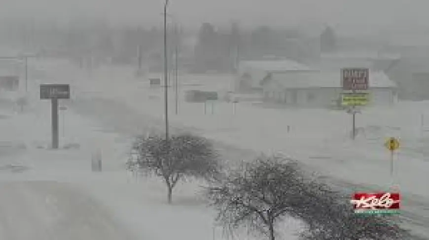
GILLETTE, Wyo. — A winter weather advisory is in effect for Campbell County from late Wednesday night through Thursday afternoon ET as accumulating snow and breezy northwest winds move into the region. Travel could become hazardous where heavier snow bands and stronger gusts combine, and residents should prepare for brief periods of low visibility and slippery roads.
What to expect and timing
Snow is expected to develop late Wednesday and continue into Thursday morning. Forecast confidence on exact totals is moderate, with some areas facing the possibility of more than 4 inches of new snow; forecasters estimate roughly a 50%–60% chance of at least that amount in parts of the county. Snow development is likely after 8: 00 p. m. ET Wednesday, with the highest probabilities of steady snowfall and peak impacts occurring overnight and into Thursday morning.
Winds will remain a complicating factor. Northwest gusts are expected into Thursday, with sustained speeds in the teens to low 20s (mph) and gusts that could reach the upper 20s to around 30 mph during the overnight period. The combination of wind and fresh snow may produce blowing snow and intermittent whiteout conditions, reducing visibility on exposed roadways and at higher elevations.
Short-term forecast details
Late Wednesday: Increasing clouds with a 30% chance of snow after 5: 00 p. m. ET and a daytime high near 33°F. Winds will shift northeast at 12–17 mph, with gusts up to 24 mph. Wind chill values could feel as low as the single digits above zero.
Wednesday night (main impact window): Snow is most likely after 8: 00 p. m. ET, with patchy blowing snow expected between about 8: 00 p. m. and 2: 00 a. m. ET. Temperatures will drop to around 2°F, with windchills as low as -14°F. North winds of 14–21 mph and gusts up to 29 mph are possible. The chance of precipitation is near 80% during this period, and 3–5 inches of new snow could fall in favored locations.
Thursday: Snow is likely, mainly before 11: 00 a. m. ET, then tapering to scattered flurries. Mostly cloudy skies and a high near 14°F are expected, with wind chills feeling near -12°F at times. Northwest winds will ease to 6–11 mph, with gusts up to 18 mph. Additional accumulations Thursday morning are expected to be light—generally less than an inch in most spots.
Thursday night into the weekend: Conditions should improve by Thursday night, turning partly cloudy with lows near -2°F. The rest of the weekend looks to trend milder and mostly sunny, with highs climbing into the upper 20s and low 30s by Sunday and early next week warmer still.
Impacts and preparedness
Roads could become slick quickly during the overnight and morning commute hours. Drivers should be prepared for reduced visibility, blowing snow on open stretches of highway, and variable accumulations that may leave untreated surfaces hazardous. If travel is not essential, delaying trips until conditions improve Thursday afternoon is advisable.
Residents should make basic preparations: check vehicle emergency kits for blankets, extra layers and a charged phone; secure loose outdoor items that could be blown around by gusty winds; and allow extra time for any necessary travel. Power outages are not broadly forecast, but strong gusts and precipitation can occasionally affect service; have a plan in place for a brief outage if needed.
When the advisory ends
The winter weather advisory for Campbell County remains in effect from late Wednesday night through Thursday afternoon ET. While overall snow amounts have trended slightly lower, conditions could deteriorate rapidly in locations where heavier bands and stronger winds align. Monitor local forecasts for any adjustments to timing or expected impacts through Thursday.