

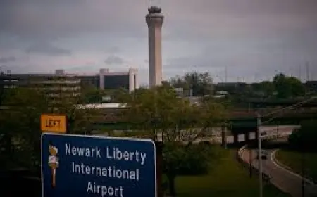


winter storm warning as blowing snow, flash flooding disrupt travel across West; Northeast threat
A winter storm warning is in effect for sections of the western United States as powerful snowfall and blowing snow combine with heavy rain to create hazardous travel and life-threatening conditions. Widespread reduced visibility, flash flooding in parts of California, and a deadly highway crash in Colorado underscore the rapidly shifting threat as the system moves eastward, with potential impacts for the Northeast by the coming weekend (ET).
Conditions on the ground
Across mountain corridors and open plains, strong winds are lifting recently fallen snow and producing widespread blowing snow that slashes visibility on major routes. Drivers are encountering whiteout conditions that make lane lines disappear and significantly increase the risk of multi-vehicle collisions. In Colorado, a fatal crash attributed to dangerous winter conditions highlights the immediate danger on snow- and ice-covered roadways.
Meanwhile, coastal and lower-elevation areas are dealing with heavy rain that has led to intense flash flooding in portions of California. Rapidly rising water has inundated streets and caused localized evacuations in flood-prone neighborhoods, complicating emergency response and travel. Emergency crews remain on alert as saturated ground raises the risk for additional runoff and debris flows.
Travel impacts and safety guidance
Travel is expected to be severely limited in affected regions while the storm is active. Motorists should expect lengthy delays, chain or traction device requirements, and intermittent closures on mountain passes and interstates. Visibility can fall to near zero in blowing snow, and hydroplaning remains a major hazard where rain is heavy.
Practical steps to reduce risk:
- Delay nonessential travel until conditions improve; leave early and allow extra time if travel is necessary.
- Keep an emergency kit in vehicles: warm clothing, blankets, water, nonperishable food, flashlight, and a fully charged mobile phone.
- Use appropriate equipment for winter roads—snow tires or chains where required—and know how to install them safely.
- Avoid driving through floodwater. Even shallow moving water can sweep a vehicle off the road.
- Monitor local road reports and be prepared for sudden closures; follow instructions from emergency responders.
What to expect next
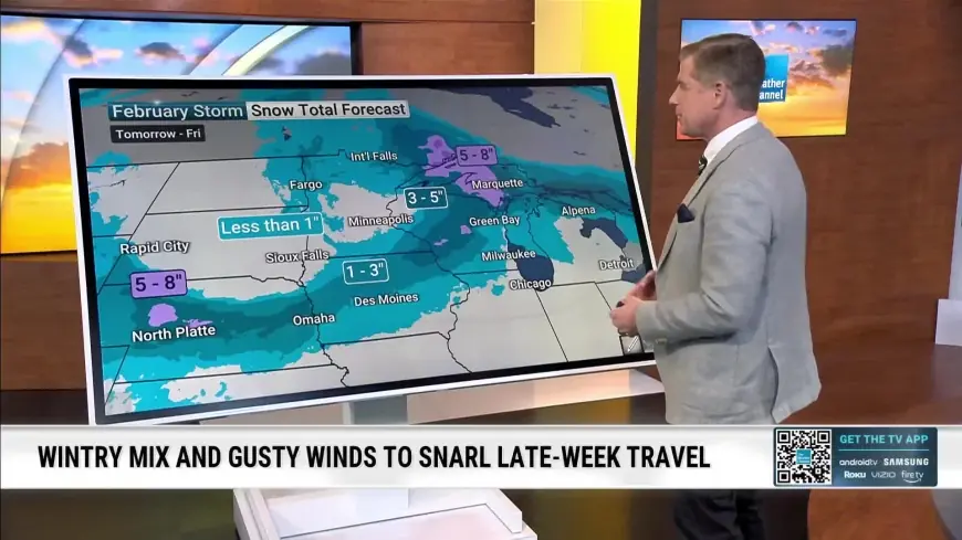
The storm complex is forecast to continue evolving through the end of the week, with the bulk of intense western impacts already underway. A shift in the storm track could carry moisture and colder air toward the central and northeastern United States, raising the prospect of snow and travel disruptions there by the weekend (ET). Residents in the potential path should prepare for arriving colder temperatures and intermittent precipitation that could transition between rain, sleet, and snow.
Communities affected by flash flooding are urged to remain vigilant for additional runoff and to heed flood safety guidance. Power outages remain possible in areas where heavy wet snow and strong winds combine to topple trees and damage lines. Emergency managers and transportation officials are closely monitoring conditions and mobilizing resources to clear critical corridors and assist stranded motorists.
With conditions changing quickly, the safest approach for residents and travelers is to prioritize caution: postpone travel when feasible, secure outdoor items that could be blown away, and make plans for extended power or mobility disruptions. The coming 48–72 hours will be critical as the system continues to move and authorities adjust alerts and restrictions in response to evolving conditions.