


los angeles weather: Evacuation Warnings Issued as Powerful Winter Storm Approaches
Los Angeles officials issued evacuation warnings for neighborhoods near recent wildfire burn scars as a powerful winter storm moved into the region, bringing heavy rain, strong winds and a heightened danger of debris flows and mudslides. A flood watch is in effect from Monday morning through Monday evening ET, and some evacuation advisories remain active into Tuesday morning ET.
Why burn scars are the biggest concern
Areas stripped of vegetation by recent wildfires are especially vulnerable. Burn scars allow rainwater to run off rapidly rather than soak in, increasing the risk of fast-moving debris flows, rock and mud slides on steep slopes and in canyons. Officials warned that debris flows can occur with little warning and can carry boulders, trees and other hazardous material downhill into populated areas.
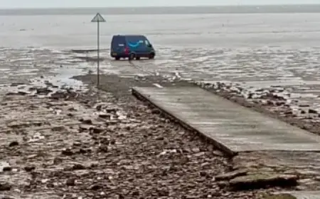
The National Weather Service warned that severe conditions are possible during the storm, including localized tornadoes, sustained wind gusts near 60 mph and rain rates that could reach about one inch per hour in heavier bands. Those conditions raise the chance of sudden flash flooding on streets and in low-lying corridors, particularly where soil has been destabilized by fire.
Evacuation warnings were issued for select parcels near recently burned zones and remain in effect through 9 a. m. ET Tuesday for some neighborhoods. Emergency management teams are treating the situation as potentially significant and urged residents in impacted areas to be ready to evacuate if an order is issued.
What officials are doing and what residents should do now
City and county response teams, including firefighters, public works crews and emergency managers, have been mobilized to prepare for potential impacts. outreach to vulnerable populations is underway, with efforts to connect people experiencing homelessness to temporary lodging and shelter resources as needed.
Residents in threatened areas should take immediate steps to reduce risk: assemble emergency go-bags with essentials and medications; secure important documents and valuables in a waterproof container; move vehicles to higher ground; and protect property by clearing gutters and downspouts where safe to do so. People with pets should have carriers and supplies ready. Avoid driving through flooded roadways — just a few inches of moving water can sweep a vehicle off the road.
Officials urged homeowners in burn-scar areas to be especially vigilant for signs of sudden runoff or debris movement, such as unusual water surges in normally dry channels, and to follow evacuation instructions without delay. Those who rely on special medical equipment should make contingency plans and keep contact information for emergency contacts and service providers readily available.
Timing, impacts and staying informed
The bulk of the heavy rain and thunderstorms is expected between Monday morning and Monday evening ET, with lingering impacts and localized advisories stretching into Tuesday morning ET for some communities. Strong gusts and localized severe weather could produce downed trees and power outages, compounding flood-related hazards.
Residents should monitor official emergency alerts and local guidance from public safety officials throughout the event. If you live in or travel through hillside communities, canyon roads or areas near recent wildfires, plan for detours and the possibility of evacuation. Check on neighbors who may need assistance, particularly older adults and people with limited mobility.
This storm underscores how quickly conditions can deteriorate in burn-scar terrain: preparedness and early action remain the best safeguards. Stay alert, avoid unnecessary travel during storm peaks, and follow any evacuation orders issued by emergency officials.