


weather los angeles: Evacuation Warnings Issued as Winter Storm Threatens Burn Scar Areas
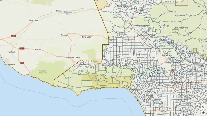
City and county officials have issued evacuation warnings for neighborhoods near recent wildfire burn scars as a powerful winter storm moves through the region, bringing heavy rain, thunderstorms and the threat of fast-moving debris flows. A flood watch is in effect from Monday morning through Monday evening ET, and some evacuation warnings remain active through 9 a. m. ET Tuesday.
Warnings and expected conditions
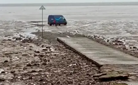
The National Weather Service said residents in vulnerable locations should begin taking precautions immediately. Forecasters warned the system could produce severe weather, including small tornadoes, sustained gusts up to 60 mph and rainfall rates approaching one inch per hour in some spots. Those conditions raise the risk of flash flooding and rapid debris flows where vegetation was recently burned.
Emergency managers highlighted steep terrain and burn scar zones as the most dangerous areas. Rock and mud slides are possible near hillsides, while debris flows — fast-moving mixtures of water, sediment and burned vegetation — can overrun streets and channels with little notice. The combination of saturated soils and heavy runoff makes roads and low-lying areas particularly hazardous.
City and county response and guidance
The mayor emphasized that city crews and first responders are mobilized ahead of the storm and ready to respond to damage and flooding. "This is likely to be another significant rain event. All Angelenos — especially those in burn scar areas — are encouraged to follow official guidance, use caution on the roads, plan ahead, and stay informed, " the mayor said.
The county executive added that multiple agencies are coordinating closely, including sheriff and fire departments, public works, and emergency management teams. Outreach efforts are focused on the most vulnerable residents; motel vouchers have been activated to expand shelter capacity and outreach teams will prioritize placements for individuals in high-risk locations. Evacuation warnings have been issued for select parcels near recent burn sites and residents in those zones are urged to remain vigilant and be ready to leave if an evacuation order is issued.
Practical steps for residents
Officials recommend that residents take the following precautions now:
- Make an evacuation plan and know multiple routes out of your neighborhood. Streets can become impassable quickly when debris or standing water is present.
- Secure loose outdoor items and move vehicles to higher ground if possible.
- Keep emergency supplies and important documents in a ready-to-go bag. Include medications, water, flashlights, batteries and a battery-powered radio.
- Avoid driving through flooded roadways. Even a few inches of moving water can sweep a vehicle off the road and deeper water can hide washed-out pavement.
- If you live below or downstream of a burn scar, be prepared to evacuate with little notice. Debris flows can travel quickly and with little warning.
Residents should monitor local emergency alerts and official channels for updates and all-clear notices. Emergency teams will continue real-time assessments and may upgrade warnings to mandatory evacuation orders if conditions deteriorate. The primary concern for officials is protecting life and ensuring rapid response to any developing hazards.
This storm underscores the compound danger that wildfire-scarred landscapes face from intense rainfall. With saturated slopes and limited vegetation to slow runoff, even brief periods of heavy rain can trigger hazardous flows. Residents in affected areas are urged to prepare now and heed evacuation guidance if issued.