


Winter Storm Warning: Up to 8 Feet of Snow Possible Across Northern California
Powerful Pacific storms moved into California beginning Sunday night, bringing heavy snow, driving winds and widespread travel disruptions. Forecasters warned that high-elevation totals could reach as much as eight feet through midweek, with blizzard-like conditions and possible road closures across the Sierra and parts of the Northstate.
Where the storm will hit hardest
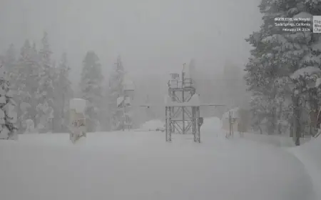
The greatest impacts are expected across Northern California, especially the western slopes of the Sierra Nevada, portions of Shasta County and areas near the coastal ranges. Forecast models show higher elevations on the western Sierra could pick up four to eight feet of snow over several days, while lower mountain elevations may see up to a foot. In higher Sierra valleys around Lake Tahoe and Mono County, three to five feet is possible, with one to three feet in lower valleys. Farther northeast, lower valleys may receive a few inches to half a foot.
Snow began falling Sunday night at elevations above roughly 5, 000 feet in the Siskiyou Mountains, Mount Shasta area and the Salmon Mountains and is expected to intensify by Monday as very heavy snowfall expands across the Sierra Nevada. A second storm arriving Tuesday could add another round of heavy mountain snow, and forecasters said that second system may be even stronger.
Travel, winds and community impacts
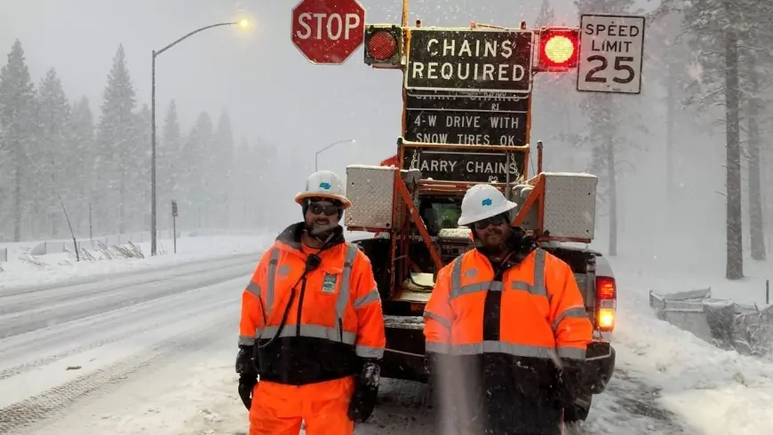
Winter storm warnings stretch from southwest Oregon into parts of Southern California, and the National Weather Service cautioned that travel in some areas could become “dangerous to near impossible. ” Major highways at risk include Interstate 80, Highway 50 and sections of Interstate 5. Officials warned of near-whiteout conditions, heavy wind gusts—forecast in some areas between 45 and 55 mph—and likely chain controls on mountain routes.
Motorists are strongly urged to avoid travel if they can. Those who must be on the road should carry chains, extra food, water and a flashlight in case they become stranded. Road crews will be working as conditions allow, but crews warn that plows will move slowly and that motorists should give them plenty of room.
High winds and coastal battering are expected to produce dangerous surf and the potential for localized flooding in low-lying coastal areas. Burn scars from recent fires increase the risk of debris flows and mudslides where heavy rain falls over steep slopes. Evacuation warnings for vulnerable neighborhoods were scheduled to take effect at 9 p. m. ET on Sunday, and residents in those areas were urged to be ready to leave on short notice.
Short-term outlook and safety steps
Forecasters expect the most intense snow to persist through Wednesday in the highest terrain, with hazardous travel conditions continuing at least through Thursday in many affected zones. Lower-elevation snowfall is possible in valleys on Tuesday, with amounts varying sharply based on elevation; places near 5, 000 feet are likely to see substantially more than adjacent lower areas.
Emergency managers advised the public to prepare now: secure outdoor items, gather emergency supplies, fill vehicle fuel tanks, and check on neighbors who may need assistance. Power utilities have activated emergency operations in anticipation of outages from heavy wet snow and strong winds.
With roads expected to be treacherous and some routes potentially closed, residents should delay nonessential trips. If travel is unavoidable, drivers should slow down, use chains when required and maintain extra distance from other vehicles. Keep flashlights, food, water and warm clothing in any vehicle used during the storm.
Officials emphasized that while parts of the state have enjoyed an unusually mild spring so far, winter conditions are not finished and could produce rapid, dangerous changes across the region this week.