


Wind advisory in effect as East Coast storm drives dangerous gusts and outages
A broad wind advisory footprint stretched across parts of the Mid-Atlantic and the Carolinas Sunday, February 1, 2026, as a rapidly intensifying coastal storm brought a mix of heavy snow, coastal flooding concerns, and damaging wind gusts. The wind threat matters beyond the coastline: strong gusts can topple trees onto power lines, worsen travel conditions by blowing snow, and push water toward vulnerable shorelines during high tides.
Key takeaways
-
Peak gusts near the coast have been forecast to reach roughly 55–70 mph in the most exposed locations, with lower but still hazardous gusts inland.
-
Wind-driven snow and poor visibility have been a primary concern where heavy bands set up, especially overnight into Sunday.
-
The highest-impact winds were expected to ease later Sunday as the storm pulls away, but some hazards can linger along the coast (surf, minor flooding).
What’s driving the strongest winds
Forecasters have been tracking a fast-deepening low-pressure system moving up the coast, with pressure falling quickly enough to tighten the gradient that produces strong winds. That setup can create a corridor of intense gusts on the storm’s western and northern sides, while also whipping ocean waves into larger surf.
Along parts of the coast, the wind has been capable of producing scattered damage—downed limbs, sporadic structural impacts on exposed properties, and interruptions to ferry service or bridge travel during the worst gusts. Inland, the bigger risk has often been trees and lines, particularly where soils are saturated or snow/ice adds extra weight.
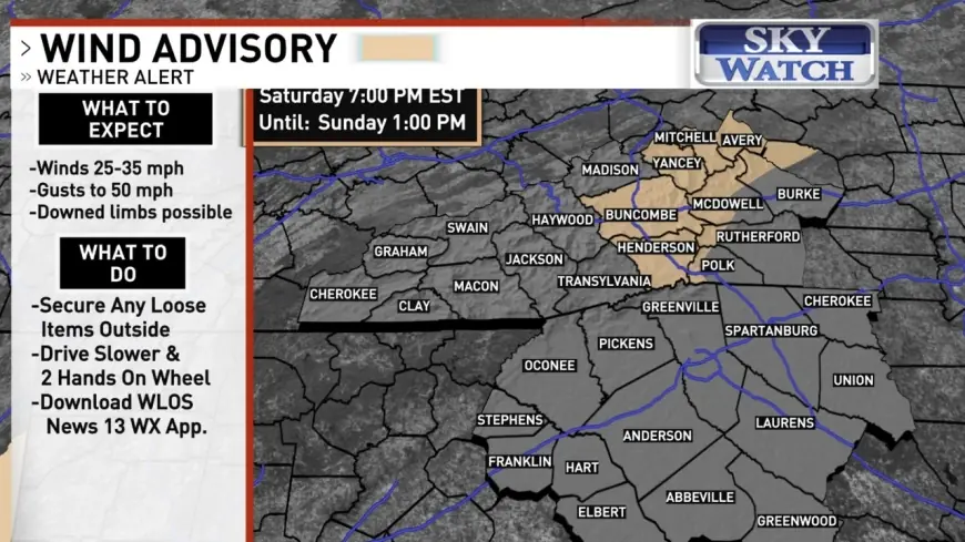
Wind advisory timing and affected areas
In several Mid-Atlantic and coastal plain zones, wind-related alerts were scheduled to ramp up Saturday night and persist into Sunday afternoon. In one of the larger clusters of alerts, wind advisories began as early as 7:00 PM ET Saturday and were set to run until around 1:00 PM ET Sunday in portions of coastal Virginia and northeastern North Carolina, while some adjacent areas had wind advisories lasting until about 4:00 PM ET Sunday.
In the most exposed coastal and barrier-island locations, higher-tier alerts were used where the risk of damaging winds was greater, with high wind warnings extending into Sunday afternoon in select zones. Marine conditions were also rough, with hazardous seas and strong onshore flow contributing to dangerous surf along parts of the coastline.
Power disruptions and travel impacts
Strong gusts arriving on top of already-stressed infrastructure have been a key concern. Areas that dealt with recent winter weather earlier in the week entered the weekend with elevated vulnerability, and additional wind has increased the odds of extended restoration timelines where new outages occur.
Travel conditions have been affected in two main ways:
-
Blowing snow and whiteouts: Where snow is falling, strong gusts can rapidly reduce visibility and create sudden drifts.
-
High-profile vehicle risk: Even without snow, gusty crosswinds can make highways and bridges hazardous for trucks, vans, and vehicles towing trailers.
Local officials in several coastal counties urged residents to limit nonessential travel during the worst conditions, and to treat downed lines as energized.
Coastal flooding and surf risks
Wind direction has been as important as wind speed along the shoreline. Persistent onshore flow can pile water against the coast, raising water levels during high tide cycles and increasing the chance of flooding in low-lying areas. At the same time, larger surf and wave run-up can accelerate beach erosion and push water across dunes and roads.
For communities on barrier islands, the combination of heavy precipitation type (snow in some places), strong gusts, and elevated tides has been especially disruptive—complicating emergency access and slowing cleanup where debris blocks key routes.
What to watch next
Conditions have been expected to improve from southwest to northeast later Sunday as the storm accelerates away from the coast, with the strongest gusts diminishing inland first. Even as winds ease, colder air lingering behind the system can keep wind chills dangerous, and leftover surf can remain hazardous at beaches and inlets.
Looking farther ahead, the pattern has stayed active, with forecast guidance highlighting another period of elevated wind potential in the second week of February. Any renewed high-wind threat will depend on the track and intensity of the next system; updates to watches and advisories may change quickly as confidence increases.
Sources consulted: National Weather Service; NOAA Climate Prediction Center; The Washington Post; CBS News


