


Boston snow totals today: Logan Airport at 18.6 inches as Massachusetts digs out from a major snowstorm
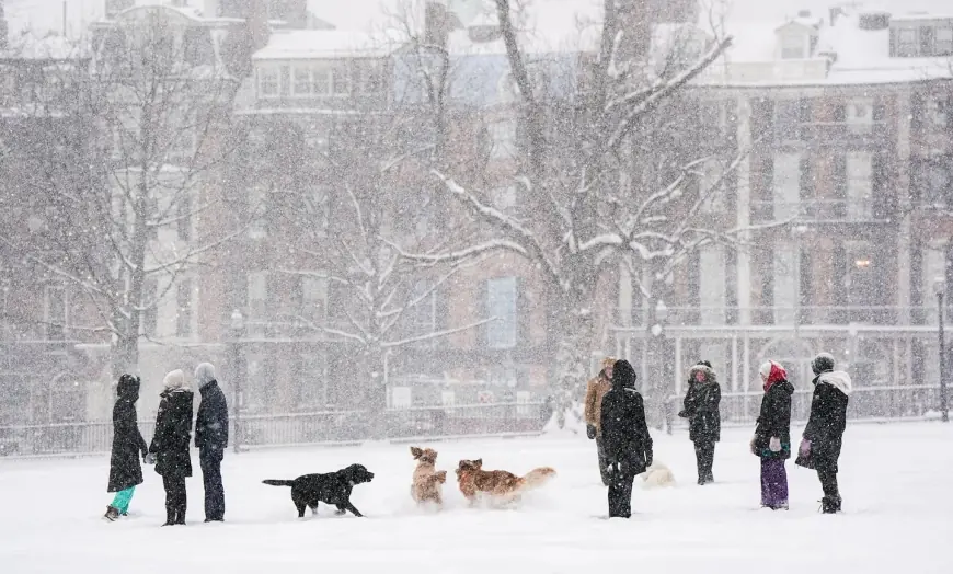
Boston woke up Monday, January 26, 2026, to a full-on “dig-out day” after a long-duration winter storm piled heavy snowfall across eastern and central Massachusetts. The headline number: the official 24-hour snowfall at Boston’s Logan Airport was 18.6 inches as of around 7:00 a.m. ET. With lighter snow and blowing snow lingering into the day, some communities were still adding to totals, and travel remained hazardous.
How much snow did Boston get today? Boston snow totals so far
Snowfall varies block by block, but official and spotter reports put Boston solidly in the mid-to-upper teens, with the city’s official benchmark coming from Logan.
A quick snapshot from widely reported official/spotter totals early Monday (ET):
-
Logan Airport (Boston): 18.6 inches
-
Dorchester: 16.8 inches
-
Chelsea: 15.2 inches
-
Arlington: 15.9 inches
-
Milton: 14.5 inches
-
Randolph: 16.0 inches
If you’re comparing “in my neighborhood” vs. “the official total,” that difference is normal: coastal exposure, banding, and wind-driven drifting can swing totals noticeably within a few miles.
Massachusetts snowfall totals: where the biggest numbers landed
While Greater Boston largely stayed under the two-foot mark early Monday, several towns and inland corridors pushed into the 20-inch range. Among the higher-end totals widely reported Monday morning:
-
Sterling: 22.2 inches
-
Hopkinton: 22.0 inches
-
Lexington: 21.0 inches
-
Uxbridge: 21.0 inches
-
Middleton: 20.5 inches
-
Worcester area reports: around the high teens to low 20s
The practical takeaway: this storm wasn’t a single uniform blanket. It was a patchwork of intense snow bands, with the “winners” often sitting just long enough under the heaviest rates.
Logan Airport, cancellations, and why Monday is a mess
Even after the snow slows, airports don’t instantly bounce back. With nearly 19 inches on the official gauge at Logan, operations shifted into recovery mode: plowing cycles, de-icing queues, staffing constraints, and aircraft positioned in the wrong cities all stack delays on top of the weather itself. That’s why a storm that peaks overnight can still disrupt schedules deep into the following afternoon and evening.
School closings, parking bans, and local emergencies
This storm triggered a classic New England response: snow emergencies, parking bans, and widespread school closures on Monday, January 26, 2026. Boston declared a snow emergency and parking restrictions to keep main arteries clear for plows and emergency vehicles, and Boston Public Schools closed for the day. Many surrounding districts and municipalities followed suit, with some shifting to remote operations for non-essential services.
Weather tomorrow in Boston: frigid, mostly quiet, and no quick melt
The storm’s “second punch” isn’t more snow—it’s the cold. For Boston:
-
Monday (Jan. 26): Snow and wind linger, with additional 1–5 inches possible in spots through the evening, highest risk near the immediate northeastern coastline.
-
Tuesday (Jan. 27): Mostly cloudy and very cold (high around the low 20s °F, low near 5 °F).
-
Wednesday (Jan. 28): Very cold, brighter skies.
That temperature profile matters because it turns cleanup into a longer grind: packed snow refreezes overnight, side streets stay slick, and melting doesn’t meaningfully help.
Behind the headline: what’s really driving the disruption
Big snowfall totals get attention, but the deeper story is timing + duration + cold. Snow that ramps up Sunday and bleeds into Monday hits the exact pressure points that make a metro area stumble: commuter travel, school decisions, and airline network scheduling. Leaders have strong incentives to call closures early—getting it “too cautious” is usually less costly than leaving people stranded on roads or in terminals.
The stakeholders are clear: public works crews facing overtime and equipment strain, hospitals and first responders trying to keep routes open, businesses balancing safety with lost revenue, and vulnerable residents who feel the cold most when power flickers or travel becomes impossible.
What we still don’t know
Final totals can still shift, especially if lingering coastal bands persist into late Monday. The other open question is operational: how quickly transit, flights, and municipal services can stabilize once plowing catches up—and whether the cold locks in hazardous conditions longer than expected.
What happens next: realistic scenarios to watch
-
Coastal banding adds a few more inches before snow fully tapers Monday evening.
-
Hard refreeze Monday night leads to a higher-than-usual Tuesday morning slip-and-fall and minor-crash risk.
-
Air travel improves in waves—some flights resume, then delays rebuild as crews reposition aircraft and staff.
-
A prolonged “dirty snow” phase (packed snow, narrowed lanes, blocked sidewalks) becomes the main quality-of-life issue for several days.
-
Localized emergency measures expand in towns hit hardest or where cleanup resources are stretched.
Why it matters: this is the kind of storm where the snowfall total is only the first chapter—the real impact shows up in the two to four days after, when cold preserves the mess and the region tries to restart normal life.