


Snowfall Weather Forecast: Warnings for snow, rain and travel disruption as cold snap continues
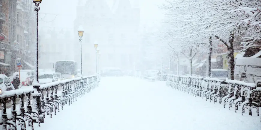
A fresh snowfall weather forecast has prompted yellow warnings for rain, snow and ice across parts of the UK, raising the risk of travel disruption and flooding as a cold snap continues. The alerts cover Northern Ireland, southern England, Wales, the Midlands and the southern Pennines and follow a plunge in temperatures that saw some places fall below -9C (16F).
Warnings active in Northern Ireland and southern England
A yellow warning for rain and snow came into force across Northern Ireland early on Wednesday morning, while a separate yellow warning for rain covers southern parts of England. Northern Ireland is expected to see a mixture of wet and wintry weather through Wednesday, with persistent rain at low levels and snow over high ground, especially the Sperrins. Any lying snow in Northern Ireland should thaw during the evening and overnight.
Snowfall Weather Forecast for Wales, the Midlands and the southern Pennines
Another yellow warning for snow is due to begin later across parts of Wales, the Midlands and the southern Pennines, with an ice warning for Wales kicking in during the evening. Chief Forecaster Jason Kelly said there is potential for rain, sleet and snow to affect parts of Wales, central England and the southern Pennines from Wednesday evening into early Thursday. He set out expected amounts: snowfall of 2-5 cm is likely above 150-200 metres, with 10-15 cm possible above 250-300 metres across mid and southeast Wales, Herefordshire, Shropshire and the southern Pennines, and small amounts, generally less than 2 cm, at lower levels.
Heavy rain totals, strong winds and coastal impacts
Southern England faces periods of heavy rain through Wednesday and into Thursday, with many areas expected to see 10-20 mm, 20-30 mm possible along the south coast and up to 50 mm across Dartmoor. Strong east to northeasterly winds will accompany the rain and large waves may affect some east-facing coasts, particularly along the English Channel. Earlier north-westerly winds contributed to the recent temperature drop; wind gusts of 45-55 mph have been identified as an extra hazard. In the wettest locations, 30-50 mm (1. 2-2. 0 in) of rain could fall, threatening to worsen flooding that has affected areas during the first part of 2026.
Travel disruption, power cuts and communities at risk in Wales
Forecasters warn of travel disruption, possible power cuts and a small chance that some rural villages could become cut off as snow and ice move across large parts of Wales. A yellow warning affecting 18 counties has been issued, with snow expected until 06: 00 GMT on Thursday and a yellow warning for ice in the same area until 10: 00 on Thursday. Travellers can expect a "small chance" of delays on roads from stranded vehicles and disruption to train and flight schedules. The counties named under the warnings are Blaenau Gwent, Bridgend, Caerphilly, Carmarthenshire, Ceredigion, Conwy, Denbighshire, Gwynedd, Merthyr Tydfil, Monmouthshire, Neath Port Talbot, Newport, Pembrokeshire, Powys, Rhondda Cynon Taf, Swansea, Torfaen and Wrexham.
Network Rail has offered a rational explanation for a closure on one line: the closure is part of engineering works taking place on the line over the school half-term break. Separately, Deputy Lyndon Farnham has called for Jersey and Guernsey to "find solutions" to inter-island travel. Local allocations include Vauvert School, the Sixth Form Centre, and Ladies College being granted a share of £3, 000, and the city council says landscaping proposals could see 49 new trees planted as part of the project.
Timing, cold alert and short-term outlook
The UK Health Security Agency has issued a cold weather alert covering most of England until 18: 00 GMT on Friday as temperatures fell across the country. Temperatures on Tuesday night dropped below -9C (16F) in parts of north-east Scotland and many northern and central areas saw a frosty start to Wednesday. Cloud amounts are increasing from the south and west, with rain pushing in across parts of Northern Ireland, Wales and southern England and already turning to snow over some hills. Some snow could also start to affect the Peak District, the Pennines and possibly south-west Scotland during the night.
Yellow National Severe Weather Warnings remain in force until Thursday morning. As the rain band shifts northwards into Wales, the west Midlands and northern England late in the day and into the evening, some precipitation will turn to snow, especially over the hills, and several centimetres are expected to accumulate on high ground above around 150-200 m, with the possibility of up to 15 cm over the highest ground of mid and south-east Wales, Herefordshire, Shropshire and the southern Pennines. The snowfall weather forecast also notes that as the system clears on Thursday most areas will turn drier, though Northern Ireland and western Scotland will see cloud and rain increasing by the afternoon and further ice warnings overnight remain possible. Into the weekend the outlook stays unsettled with further bands of rain mixed with brighter intervals and the possibility of milder Atlantic air later in the period.