


Blizzard Warning: Major Snowstorm Poised to Slam NYC and Tri-State Area
A blizzard warning has been issued as a powerful winter storm heads for New York City and the Tri-State area Sunday night into Monday, threatening blizzard conditions, dangerous travel and possible widespread power outages. The scale and timing of the event matter because the system could become the region's largest snow-maker since January 2016 and may deliver prolonged, intense bands of snow when commutes peak.
Blizzard Warning Covers Long Island, All Five Boroughs, Westchester and Rockland
Blizzard Warnings are in effect for Long Island, all five boroughs, Westchester and Rockland counties, coastal Connecticut and much of New Jersey. The last time the area faced a blizzard warning was March 2017, underscoring the rarity of this alert. The storm meets blizzard criteria with expected winds gusting at least 35 mph, heavy snow and visibility under a quarter mile for a sustained period.
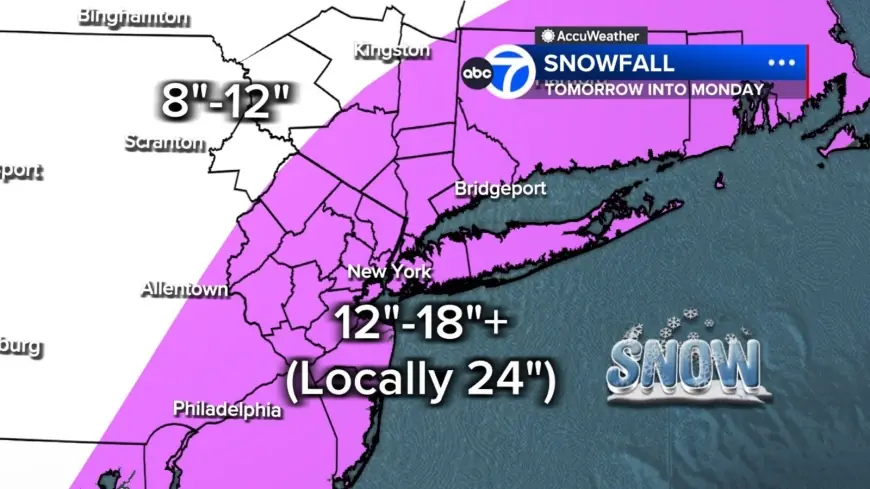
Snow Rates Projected at 2 to 3 Inches per Hour; Most Areas 12–18 Inches
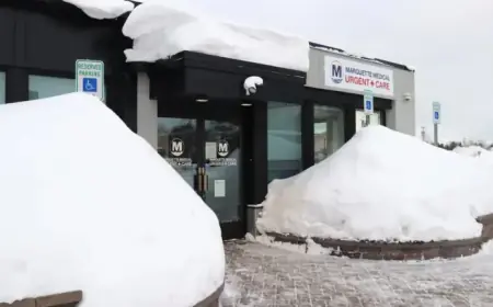
Forecasts call for intense snow bands that could drop 2 to 3 inches per hour and linger overhead for hours. Most of the region is projected to receive 12 to 18 inches of snow, with localized totals of 24 inches or more where the heaviest bands stall. Long Island and parts of the Jersey Shore have the highest likelihood of reaching those extreme totals. Farther north and west, including the Poconos and Catskills, are expected to see lower amounts—roughly 8 to 12 inches—because those areas have less access to the storm's core moisture.
Wind Gusts Over 40 MPH, Up to 60 MPH on Long Island, Raise Outage Risk
Winds will increase through Sunday and peak overnight, with gusts over 40 mph across the region and potentially up to 60 mph on Long Island. Combined with wet, heavy snow, those gusts create a significant risk for downed trees and power outages. Because heavy, moisture-laden snow adheres to branches, the likely effect is accelerated tree failure and utility damage during the height of the storm.
Timing: Quiet Saturday, Midday Sunday Onset, Intensification After Sunset
Conditions are expected to be quiet Saturday evening before clouds thicken overnight. A few rain or snow showers may appear early Sunday while temperatures remain above freezing to start the day. By midday Sunday visibility should begin to fall as steadier snow develops, especially from New York City south and west. After sunset, temperatures will drop and the storm is expected to rapidly intensify offshore, pulling heavy snow bands directly into the region. The area may see 10 to 12 hours of true blizzard conditions Sunday night into Monday, with snow gradually tapering Monday afternoon but gusty winds and scattered blowing snow continuing.
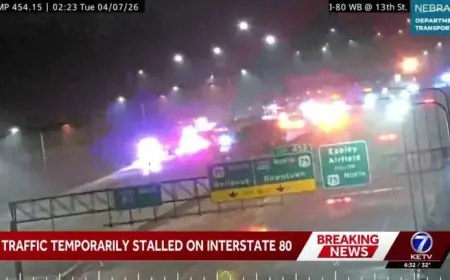
Airlines, Commutes and Cleanup: Suspensions and a Tough Monday Morning
American Airlines has announced it will suspend operations at LaGuardia, JFK and Philadelphia beginning Sunday afternoon through the day Monday because of the storm. The carrier said teams are working around the clock and will be ready to resume operations at those airports on Tuesday, Feb. 24 as soon as conditions allow safe operations. Road conditions are expected to deteriorate rapidly Sunday evening, and the Monday morning commute may be impossible in some areas. Tuesday will turn colder and breezy with cleanup underway, and another system is possible Wednesday though early indications suggest it will be significantly weaker.
Jeff Smith, a meteorologist providing forecasts for the region, characterized the system as potentially one of the most significant snowstorms in years. The storm's structure—energy from the Ohio Valley colliding with Gulf and ocean moisture—resembles a winter hurricane and helps explain the potential for prolonged, intense snowfall. What makes this notable is that the combination of high snow rates, extended blizzard-duration and very strong coastal gusts elevates the risk of widespread disruption beyond typical heavy snow events.
Residents in warned areas should prepare for lengthy travel disruptions, possible power outages and dangerous conditions through Monday, with recovery and cleanup extending into Tuesday and beyond.