


Snowfall Weather Forecast: Warnings, travel disruption and heavy rain across the UK
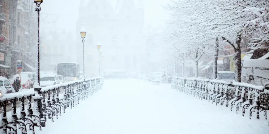
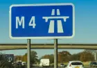
The Snowfall Weather Forecast today highlights a patchwork of yellow warnings for rain, snow and ice across the UK, with travel disruption, flooding risk and possible power cuts as key concerns. Warnings are active across Northern Ireland, southern England, Wales and parts of the Midlands and Pennines, and the spread of rain and wintry precipitation into higher ground makes this a disruptive cold snap for many communities.
Snowfall Weather Forecast: who is warned and when
Yellow Met Office warnings cover rain and snow in Northern Ireland and rain across southern England that will persist into Thursday morning. A separate yellow warning for snow is due to begin later for parts of Wales, the Midlands and the southern Pennines, and an ice warning for Wales will kick in during the evening. In Wales, a yellow warning affects 18 counties with snow expected until 06: 00 GMT on Thursday and a yellow warning for ice in the same area in effect until 10: 00 on Thursday.
Rain, wind and flood risk across southern England
Frontal systems are bringing heavier rain to southern counties. Many areas are expected to see 10-20 mm, with 20-30 mm possible along the south coast and up to 50 mm across Dartmoor. In the wettest locations, 30-50mm (1. 2-2. 0in) of rain could fall, creating a real risk of worsening flooding in areas already affected earlier in the year. Strong east to northeasterly winds will accompany the rain in southern England, and large waves may affect some east-facing coasts along the English Channel.
Wales: 18 counties warned, travel delays and rural cut-off risk
Forecasters warn of travel disruption, possible power cuts and a chance that some rural villages could become cut off as snow and ice move across large parts of Wales. People living on higher ground in mid and southeast Wales could see up to 20cm (8in) of snow. The counties named in the warning include Blaenau Gwent, Bridgend, Caerphilly, Carmarthenshire, Ceredigion, Conwy, Denbighshire, Gwynedd, Merthyr Tydfil, Monmouthshire, Neath Port Talbot, Newport, Pembrokeshire, Powys, Rhondda Cynon Taf, Swansea, Torfaen and Wrexham. Travellers should expect a small chance of delays on roads due to stranded vehicles and disruption to train and flight schedules, with a small chance of cuts to power and mobile service where strong winds are forecast.
Northern Ireland, high ground and hill snow accumulation
Northern Ireland will see a mix of wet and wintry weather, with persistent rain at low levels and snow over high ground, especially the Sperrins. Across Northern Ireland, a yellow warning covers rain that is falling as snow over high ground before easing later; lower levels are likely to see little or no lying snow while several centimetres could accumulate above 250 metres. Some of this lying snow is expected to thaw during the evening and overnight. Several centimetres of snow are expected to accumulate over high ground above around 150-200m elevation elsewhere, with the possibility of up to 15cm over the highest ground of mid and south-east Wales, Herefordshire, Shropshire and the southern Pennines. At low levels a mix of rain and sleet is more likely, with a little wet snow at times. Some snow could also start to affect the Peak District, Pennines and possibly south-west Scotland during the night.
Cold snap background, gusts and health notice
North-westerly winds have driven a drop in temperatures in recent days. The UK Health Security Agency (UKHSA) has issued a cold weather alert covering most of England until 18: 00 GMT on Friday. Temperatures on Tuesday night dropped below -9C (16F) in parts of north-east Scotland, and many northern and central parts of the UK saw a frosty start to Wednesday. Wind gusts of 45-55mph are an extra hazard in exposed areas and strong southeasterly or northeasterly winds may increase impacts, including the risk of ice as temperatures fall overnight. There remains some uncertainty in the evolving forecast and it will be important to keep up to date with hour-by-hour guidance from official weather services.
Local non-weather items in the coverage
Alongside meteorological warnings, recent coverage included a Network Rail explanation for a closure that may look dramatic but is linked to engineering works on a line during the school half-term break. A deputy called for Jersey and Guernsey to find solutions to inter-island travel. Local education grants were noted: Vauvert School, the Sixth Form Centre, and Ladies College were each granted a share of £3, 000. A city council said landscaping proposals could see 49 new trees planted as part of a local project.
Warnings remain dynamic and conditions can change; keep an eye on official updates for the latest hourly forecast and safety guidance for travel, flooding and cold-related health risk.