


Nws: Strong winds and heavy rain to impact northwest California after a short break
nws products show a brief window of clearer weather will give travelers a short break today, but interior Humboldt, Del Norte, Trinity, Mendocino and northern Lake counties face renewed hazards as a Cold Weather Advisory remains in effect and a Wind Advisory starts late Friday night.
Nws issues Cold Weather Advisory, then a Wind Advisory
The National Weather Service in Eureka has issued a Cold Weather Advisory for interior Humboldt, Trinity, Mendocino, northern Lake and Del Norte counties effective until 9 a. m. Friday, with wind chills expected as low as 15 degrees on higher terrain and exposed routes.
A Wind Advisory will follow, taking effect at 10 p. m. Friday and continuing through 10 a. m. Sunday for the same interior areas; forecasters call for southeast winds of 20 to 30 mph with gusts up to 55 mph along windward ridges and exposed headlands. Those gusts can make driving difficult on ridge tops, through gaps and on open stretches, and create the risk of blowing debris and falling branches.
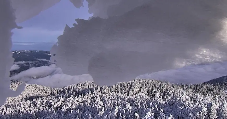
Snow, road cameras and what crews are seeing
Snow that stacked up on Horse Mountain and near the Collier Tunnel, Berry Summit and Shasta River Bridge on I-5 is already visible on traffic cameras; Ridgewood Summit south of Willits was cold but clear on the same set of cams as of 5 p. m. yesterday. Caltrans’ Quick Map is cited for the current highway and county road condition updates that crews are monitoring across the region.
Timing matters for travel: rain returns late Friday evening
For today, the region sees a relative lull that may ease travel, but rain is expected to return late this evening and into the weekend, with periods of heavy rain possible at times. The Wind Advisory beginning at 10 p. m. Friday will coincide with that shift, increasing the hazard on higher-elevation and exposed roadways in the interior counties.
Drivers should be ready for sudden crosswinds on high-profile vehicles and reduced visibility where heavy rain falls; the nws note about blowing debris and falling branches underscores the threat on rural, forested routes. Local agencies have posted road condition notes and some Humboldt County roads were listed as closed as of 5 p. m. yesterday.
Recovery and road work crews are expected to monitor conditions through the advisory periods; the immediate schedule to watch is the Cold Weather Advisory in effect until 9 a. m. Friday and the Wind Advisory from 10 p. m. Friday through 10 a. m. Sunday, with Caltrans’ Quick Map offering the latest highway and county road conditions.