


Omaha weather: Late Thursday snow, strong winds could snarl evening commute
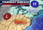
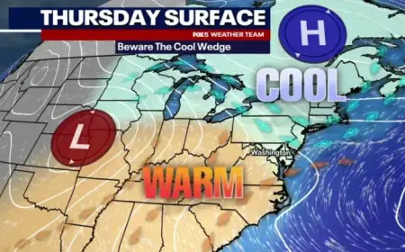
A fast-moving system will bring a switch from mild springlike conditions to wintry weather for Omaha Thursday. Snow chances rise late in the day with gusty winds and a colder air mass that could make travel difficult by the evening commute and through the night into early Friday morning ET.
Timing and how much to expect
Clouds will dominate much of Thursday, and most of the morning should remain dry. Snow chances increase past 3: 00 PM ET, with the initial precipitation likely starting as wet snow that may briefly melt on contact because surface temperatures are expected to be in the low 40s earlier in the day.
Accumulation becomes more likely after sunset as temperatures fall. The biggest totals are expected north of the metro, though some guidance shows heavier snow hanging closer to I-80. Locally higher snow rates cannot be ruled out at times, especially during the late afternoon into the early evening when the system is most active.
Travel impacts are most likely for the evening commute and later in the night. Road conditions may deteriorate quickly once accumulation begins and blowing snow reduces visibility in stronger gusts.
Wind, temperatures and travel impacts
Winds will pick up through the evening with gusts up to about 40 mph, which will blow falling snow and cause visibility to fall at times. Wind-driven snow will create slick, snow-covered roads and drifting in exposed locations.
Temperatures will tumble from the unseasonably warm readings earlier in the week into the low 40s Thursday afternoon, then fall into the 20s and teens by evening. Combined with the wind, wind chills are expected to drop into the teens by late Thursday evening ET.
Expect hazardous travel where snow begins to accumulate and visibility drops. The highest likelihood of significant travel problems will be north of I-80, but pockets of slick conditions and slower commutes are possible across the metro during peak travel times.
Short-term outlook and what to watch for
- Storm window: Snow begins late Thursday afternoon, with the most widespread impacts during the evening and into the night. Warnings and advisories are expected to remain in effect into early Friday morning, typically through 6: 00 AM ET for affected counties.
- Accumulation: Greater amounts favored north of the metro; minor accumulations possible across and south of I-80 once temperatures fall in the evening.
- Intensity: Brief bursts of heavier snow are possible, which could produce rapid reductions in visibility and localized quick accumulations.
- Winds: Gusts up to 40 mph will enhance blowing snow and increase travel hazards. Expect the strongest winds in the late afternoon and evening periods.
After the main system departs early Friday, conditions should quiet down, but another weak disturbance could clip the region overnight Friday, bringing only light additional snow or flurries for some areas. Daytime temperatures heading into the weekend will remain below recent levels, with readings mainly in the 30s and colder wind chills.
Drivers should plan for slower trips Thursday evening and into the overnight hours and keep extra time for commutes. If travel is necessary, carry an emergency kit, allow for additional stopping distance, and be prepared for sudden changes in visibility from falling and blowing snow.