


Midwestern Heat Spike and Severe Risk: weather tomorrow brings near-record warmth then storms
Unseasonably warm air will surge across parts of the Midwest this week, pushing highs into the upper 60s in places and even breaking long-standing records in Indianapolis. The warmth is short-lived: a warm front then a stronger cold front will trigger thunderstorms Thursday, creating a window for severe weather late in the day and into the evening (all times ET).
What to expect Wednesday and Thursday
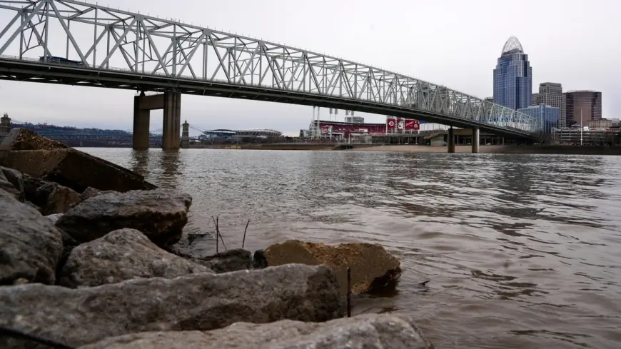
Warm, southwest winds will lift temperatures into the mid- to upper-60s Wednesday and again Thursday. In Cincinnati, morning showers are likely Wednesday, with rain mainly before 9 a. m., then partial clearing and a high near 68. Overnight lows will remain mild, keeping some locations in contention for record-high minimums for Feb. 18. By Thursday a developing warm front will push through the region, with thunderstorms possible after 4 p. m. and a daytime high near 69.
In Indianapolis the mercury climbed into the upper 60s on Wednesday and briefly hit 70 by midafternoon, breaking a daily high that had stood for decades. That run of unusually warm readings will give way quickly: a cold front is expected Friday, knocking highs back into the 40s and bringing much cooler air for the weekend.
Severe threat late Thursday into Thursday night
Forecasters are flagging Thursday afternoon and evening as the period with the greatest concern for severe storms. A regional outlook highlights a slight risk area that includes parts of southwestern Indiana, southern Illinois and western Kentucky, with the most pronounced threat east of Interstate 57 and near and north of Interstate 64. Storms are most likely to arrive between about 1 and 7 p. m. ET, though timing could shift as the front progresses.
The main hazards will be damaging straight-line winds and the possibility of a few tornadoes. Small hail could accompany the stronger cells. Forecast guidance indicates the greatest potential for severe outcomes will be during the late-day heating and early evening hours when wind shear and instability come together along the frontal boundary.
Rainfall totals from Thursday into Thursday night are likely to range from a few tenths of an inch to a half-inch in many spots, with localized higher amounts within thunderstorms. People in the risk corridor should be prepared to move quickly to shelter if thunderstorm warnings are issued late Thursday.
Outlook through the weekend and what residents should do
After the line of storms crosses the region, temperatures will fall sharply. Friday will be noticeably cooler, with highs returning to the 40s and a raw feel to the air. The weekend looks much more seasonable: Saturday near 49 and mostly sunny, then cooler again Sunday with highs in the upper 30s and continued mostly cloudy skies. Overnight lows dip into the 20s by Sunday night and into the low 20s and teens early next week.
Practical steps for the coming days include monitoring updated forecasts and watches, having a plan for where to shelter if severe thunderstorm or tornado warnings are issued, and securing loose outdoor items before the Thursday wind event. The rapidly changing temperature profile — near-70s one day then a swing back to the 30s and 40s the next — underscores the need for flexible plans and timely weather information.
Forecasters emphasize that while the warm spell is notable and record-adjacent in some locations, the principal concern over the next 48 hours is the potential for severe thunderstorms tied to the frontal passage Thursday into Thursday night (all times ET).