


Winter Storm Prompts Evacuation Alerts as weather los angeles Braces for Heavy Rain
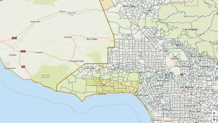
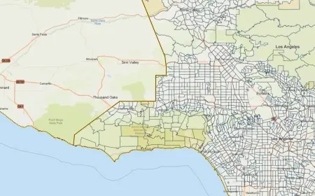
Los Angeles officials issued evacuation warnings for neighborhoods near recent wildfire burn scars as a powerful winter storm moves through the region. A flood watch covers much of Los Angeles County from Monday morning through Monday evening ET, with emergency teams mobilizing and residents urged to prepare for flash flooding, debris flows and severe winds.
Evacuation warnings and local preparations
Evacuation warnings are in effect for select parcels adjacent to areas burned by recent wildfires, with those alerts remaining in place through 9 a. m. ET Tuesday. City and county agencies activated response plans over the weekend. Crews from public works, fire and sheriff units are positioned to respond to road closures, downed trees and localized flooding.
Officials emphasized protecting the most vulnerable residents. Outreach teams and housing services are coordinating efforts to connect people at risk with shelter options, including motel vouchers and temporary placements where needed. Residents in high-risk areas are being urged to stay ready to leave on short notice and to keep essential items and documents accessible.
Recommended immediate actions for people in or near burn scar zones:
- Plan an evacuation route and identify a meeting point away from slopes and channels.
- Move vehicles and valuables to higher ground if safe to do so.
- Pack an emergency kit with medications, water, charged phones, flashlights and important documents.
- Avoid driving through flooded roads; turn around, don’t drown.
- Monitor official emergency alerts and be prepared to act if an evacuation order is issued.
Storm threat: heavy rain, winds, debris flows and other hazards
The National Weather Service warned that the system could deliver intense bursts of rain and thunderstorms capable of producing one-inch-per-hour rainfall rates in some locations. Strong gusts—potentially reaching 60 mph—and the possibility of small tornadoes are part of the forecast, raising the risk for power outages and fallen trees.
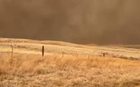
Steep slopes and recently burned hillsides are at elevated risk for rock and mud slides, and debris flows remain a primary concern where vegetation was lost in past fires. Debris flows can travel rapidly and with little warning; they often follow natural channels and can inundate roads and homes below burn scars.
Travelers and commuters should anticipate hazardous conditions on regional roadways through Monday evening ET and into Tuesday morning in areas with prolonged rainfall. Slow driving speeds, increased stopping distances, and avoidance of exposed ridgelines or canyon routes are advised while crews work to clear affected corridors.
What residents should watch for and where to get help
Residents should keep battery-powered radios or cellphone alerts enabled for emergency notifications and evacuation instructions. Expect periodic updates from city and county emergency management offices during the threat period. If you live in a designated warning area, prepare to evacuate immediately if an order is issued.
Local sheltering support and outreach efforts are being prioritized for people experiencing homelessness and others with limited resources. If you encounter an urgent hazard—rapidly rising water, debris flows, or downed power lines—move to higher ground and contact emergency services if safe to do so.
This storm is characterized as likely to produce significant impacts; officials emphasized that early preparation and prompt response will be critical to minimizing harm. Stay alert, follow official guidance, and avoid areas prone to flooding or slope failure until the region has passed the immediate threat.