


Coastal Flood Advisory Issued: What It Means, Why It Happens, and What Residents Should Do Next
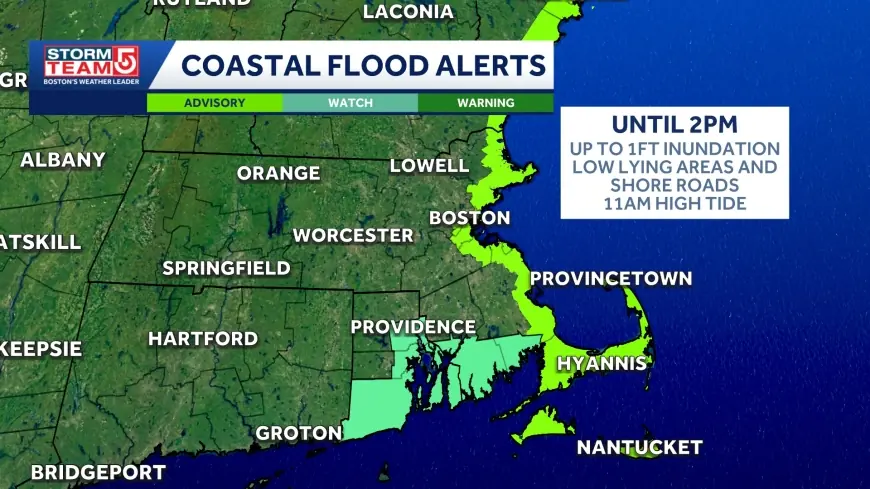
A coastal flood advisory is a near-term warning that water levels along the shore may rise high enough to cause minor flooding in low-lying coastal areas. It is not the most severe flood alert, but it is a signal that the ocean is expected to push past its usual boundaries, often affecting beach roads, parking lots, marinas, docks, and neighborhoods built close to sea level. For coastal communities, the practical impact can show up quickly: saltwater on streets, water in storm drains, splash-over onto seawalls, and conditions that can turn routine commutes into detours.
Coastal flood advisory vs. more serious flood alerts
A coastal flood advisory typically indicates minor flooding is possible or expected in vulnerable areas. It often accompanies “nuisance flooding,” where water disrupts daily life but does not usually cause major structural damage.
More serious alerts generally imply higher confidence and greater impacts, such as:
-
Water reaching deeper into neighborhoods
-
More widespread road closures
-
Higher risk of property damage
-
Greater danger around surf zones and inlets
The key point: an advisory is not “nothing.” Minor flooding can still strand vehicles, damage landscaping and foundations over time, and create hazardous driving conditions because saltwater can hide potholes, debris, or compromised pavement.
What’s behind the headline: why coastal flooding can spike even without a big storm
Coastal flooding is often misunderstood because it can happen on sunny days. The most common drivers include:
Astronomical tides
Some tide cycles run higher than average, and when they align with other factors, water can crest above typical thresholds.
Onshore wind
Sustained winds pushing toward land can “pile up” water against the coast, raising local water levels.
Low atmospheric pressure
Lower pressure can allow sea level to rise slightly, which matters most when it coincides with high tide.
Ocean swell and wave run-up
Even if overall water levels are only modestly elevated, strong surf can send water over seawalls, dunes, and coastal roads.
Rainfall and drainage backflow
Heavy rain at the same time as high tide can prevent stormwater from draining, causing water to pool inland. In some neighborhoods, saltwater can also push into drainage systems, making street flooding worse.
Who’s most affected, and why the incentives matter
A coastal flood advisory doesn’t hit everyone equally. The stakeholders are clear:
-
Residents in low-lying neighborhoods face driveway and street flooding, plus long-term saltwater intrusion that can degrade foundations and utilities.
-
Commuters and local businesses are impacted by road closures and customer access issues, even if flooding is “minor.”
-
Marina operators and boat owners must adjust lines, check pilings, and protect equipment as water levels fluctuate quickly.
-
City and county crews deal with temporary barriers, drain clearing, and emergency routing decisions that can strain staffing.
The incentives can also shape outcomes. When advisories are frequent, some people become numb and delay action. Meanwhile, municipalities must balance the cost of repeated short-term responses against longer-term infrastructure investments like elevating roads, adding pump capacity, or restoring natural buffers.
What to do during a coastal flood advisory
If you live or travel near the shoreline, focus on the basics that prevent the most common losses:
-
Avoid driving through saltwater. It can stall engines, damage brakes, and corrode electrical systems.
-
Move cars off low-lying streets and lots before the highest water arrives.
-
Plan detours early. The first closure can trigger traffic backups far beyond the flooded block.
-
Secure waterfront property: trash bins, patio furniture, small boats, and gear can float away or become debris.
-
Use extra caution near inlets and jetties: water and waves can surge unpredictably, and slippery rocks are a major injury risk.
-
Check vulnerable drains near your home if it’s safe to do so; blocked storm grates can turn a shallow nuisance event into deeper pooling.
What we still don’t know in most advisory situations
Even with modern forecasting, the “last mile” of coastal flooding is local. Impacts can vary block by block depending on:
-
Exact tide timing and peak height
-
Wind direction shifts during the peak window
-
Wave energy at specific beaches
-
Local drainage performance and prior debris buildup
That uncertainty is why some advisories feel underwhelming while others produce surprising street flooding.
What happens next: realistic scenarios and triggers
-
Minor flooding stays localized
Trigger: winds ease before the high-tide peak and surf remains moderate. -
Brief but disruptive road flooding around peak tide
Trigger: peak tide coincides with onshore wind and moderate swell. -
Repeat advisories over multiple tide cycles
Trigger: a multi-day pattern of elevated tides and persistent onshore flow. -
Escalation to a more serious coastal flood alert
Trigger: stronger winds, lower pressure, or larger swell arriving near peak tide. -
Longer-term infrastructure debate reignites
Trigger: visible repeat flooding in the same hotspots, pushing pressure for drainage upgrades, road elevation, seawall improvements, or nature-based buffers.
A coastal flood advisory is best treated as a short, actionable window: expect water where it usually creeps in, plan around the peak tide timing, and reduce exposure to saltwater damage. In many coastal areas, “minor” flooding is also a reminder of a bigger trend: the baseline is rising, and the threshold for disruption keeps getting easier to reach.