


Cold and Snow Intensify This Week as Weekend Approaches
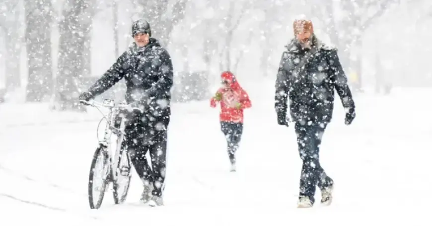
This week, a significant winter weather pattern is affecting a large portion of the United States, intensifying as the weekend approaches. Two rounds of arctic cold have already struck many regions, setting the stage for a potentially disruptive winter storm.
Cold Weather Alerts Across the U.S.
On Monday, approximately 77 million people awoke to cold weather alerts. These alerts covered two primary regions: from the northern Plains to the Northeast and across Florida. In northern cities such as Chicago and Albany, wind chills plummeted to as low as 20 to 30 degrees below zero.
In Florida, cities like Tampa and St. Petersburg, which rarely see such low temperatures, experienced wind chills between 20 and 30 degrees. Although these alerts were expected to expire by midmorning in Florida, afternoon highs remained 10 to 25 degrees below average.
Forecast for the Week
- Monday: The coldest day for the Upper Midwest and Great Lakes regions.
- Tuesday: The coldest day forecast for the Northeast, with New York City seeing wind chills in the single digits and teens.
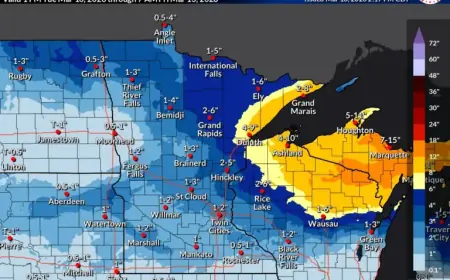
On Monday, accumulations of over 8 inches of snow were reported in parts of Michigan and New York due to lake-effect snow. This phenomenon blanketed typical snowbelt areas downwind of Lakes Michigan, Erie, and Ontario.
Impact of Winter Weather
Harsh winter conditions contributed to a significant 100-vehicle pileup near Grand Rapids, Michigan, leading to extended road closures on Interstate 196.
Upcoming Winter Weather Developments
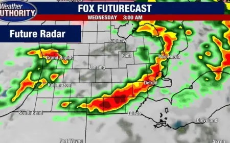
On Tuesday, a clipper system descending from Canada will move through the Dakotas, Minnesota, and Iowa, with light snowfall expected in Minneapolis. The same system will bring snowfall to the Great Lakes and parts of the Northeast and New England on Wednesday.
While current cold weather and snow will create wintry visuals, the expected totals will not be extraordinary. However, a later winter storm could bring record-setting conditions.
Forecast for the Weekend
Beginning Friday, arctic air will sweep through the northern Plains and Upper Midwest before reaching the Southeast and Northeast throughout the weekend. Wind chills may plummet to 30 degrees below zero, with some areas experiencing temperatures as low as 40 to 50 degrees below zero.
This forthcoming weekend may present the coldest air of the season thus far, potentially becoming the coldest of the entire winter. The extent of the arctic air will influence the development of a significant winter storm expected to deliver widespread snow and ice across the southern U.S. from Friday to Sunday.
Uncertainty in Forecasting
Forecasters have identified a high-impact winter storm is on the horizon, but uncertainties remain regarding the exact details. The National Weather Service in Fort Worth, Texas, has already warned residents about freezing temperatures and potential hazardous conditions.
As weather models continue to refine their predictions, it appears that the second half of January will bring extremely cold temperatures to much of the U.S., creating a significant winter weather situation.