


‘Super El Niño Approaches, Yet Bigger Climate Threats Loom’

Scientists report a growing pool of warm water moving beneath the tropical Pacific. This subsurface heat is reorganizing surface conditions toward an El Niño event.
Subsurface buildup and ocean dynamics
Researchers at the European Centre for Medium-Range Weather Forecasts found warm water spreading east below a cooler surface layer. That imbalance often precedes rapid surface warming and informs seasonal forecasts.
When trade winds weaken, warm surface water can shift east. Westerly wind bursts can launch Kelvin waves that push warm water toward South America and deepen the thermocline.
How forecasters measure change
Scientists monitor temperature anomalies, or departures from long-term averages. The Niño 3.4 region remains central to official indexes.
Noaa’s updated verification uses a relative index. Roughly 0.9 degrees Fahrenheit above average still marks basic El Niño conditions.
Model forecasts and probabilities
Noaa’s Climate Prediction Center placed the odds of El Niño at 62 percent for June through August. Their March outlook expected development between June and August 2026.
By mid-April, forecasters raised end-of-year confidence. They still allowed about a one-in-four chance of a very strong event.
EcMWF ensemble forecasts in April ranged from weak warming to near 5.9 degrees Fahrenheit. That spread helps explain why certainty remains limited.
Spring predictability barrier
Forecast skill is lowest in spring. Scientists call this the spring predictability barrier.
A missed wind burst or timing error can push models off course. Forecasters remain cautious despite strong early signals.
Possible weather and ecological impacts
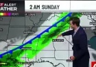
If Pacific warming continues, the winter jet stream over North America tends to shift south. That pattern often brings wetter conditions to the southern United States.
Northern regions may see milder and less stormy winters. Over the Atlantic, stronger upper-level winds can shear developing hurricanes.
Along the South American coast, weaker upwelling reduces nutrient-rich cold water. That change can cut plankton food, affect fish and seabirds, and harm coastal livelihoods.
Warmer coastal waters may also draw tropical species closer to shore. These ecological shifts often appear before many distant weather impacts.
Why the coming weeks matter
New westerly winds in the western Pacific could push more warm water eastward. If that happens, subsurface heat should rise and surface temperatures may follow.
Without another strong wind push, 2026 could still end as a more ordinary El Niño. Some models, however, keep open the possibility of a Super El Niño.
Planning and preparation
Seasonal forecasts change risk assessments for water managers, farmers, fishers, and emergency planners. Early warning gives communities time to prepare.
EcMWF designed a seasonal forecasting system to improve prediction in the central Pacific. The related study appears in Geoscientific Model Development.
Experts caution that bigger climate threats loom beyond a single El Niño. Warming oceans and shifting weather patterns increase long-term risks for ecosystems and societies.