


Heat Persists Before Approaching Cold Front Offers Relief
Heat persists across the Atlanta area into Saturday, keeping afternoon temperatures well above normal. A change in the pattern arrives late Saturday night as a cold front moves in.
Saturday forecast
Saturday will be warm and mostly sunny. Highs are forecast in the mid to upper 80s across metro Atlanta.
Some central Georgia locations could approach 90 degrees. Only a few late afternoon clouds are expected.
Fire danger
Fire risk will remain elevated Saturday. Warm temperatures, low humidity, and dry vegetation increase the chance of rapid fire spread.
Residents should avoid open flames and follow local burn restrictions.
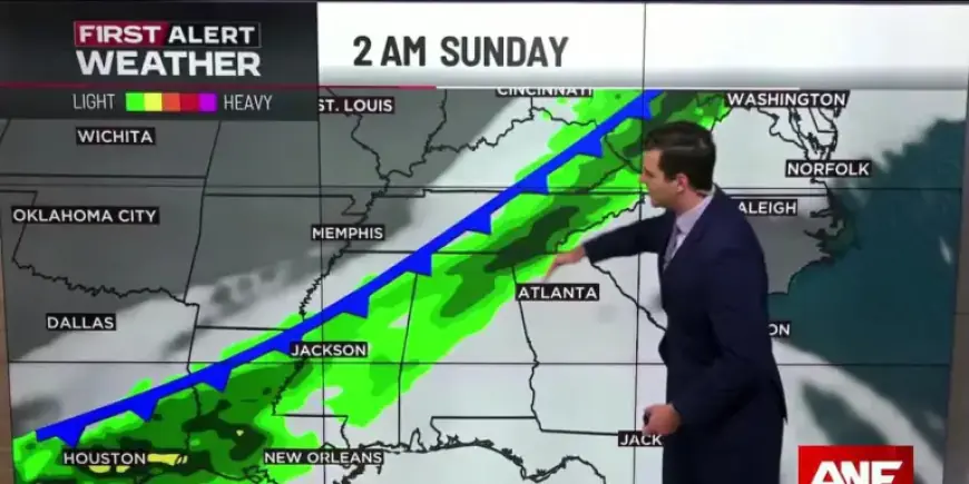
Sunday outlook
The cold front moves through late Saturday night into Sunday morning. Showers are possible mainly across northwest parts of the state.
Any precipitation should end by late morning, leaving most of Sunday dry and suitable for outdoor plans.
High temperatures will fall into the upper 60s to lower 70s. Rain totals should be light, around a tenth of an inch or less.
This limited rainfall will not significantly relieve the ongoing dry conditions.
Early week and beyond
High pressure builds in Monday, returning dry weather and near-normal temperatures to start the week. Temperatures will climb gradually through the week.
By Thursday, highs are expected to rise back into the mid to upper 80s.
Report for Filmogaz.com.