


Columbus Weather Alert: Severe Thunderstorm Warnings Active Until 11 PM
Filmogaz.com is reporting scattered severe weather across central Ohio this evening. A watch was extended into some western counties, and warnings are in place for multiple counties.
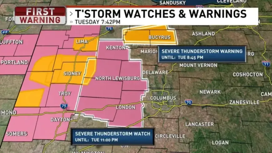
Active alerts and immediate threats
Severe thunderstorm warnings are affecting Hardin, Wyandot, and Crawford counties. Large hail and damaging wind gusts are the primary hazards. This Columbus weather alert notes the severe thunderstorm warnings are active until 11 PM in affected zones.
Current conditions
The region is warm and humid tonight. Showers and thunderstorms are occurring in several locations. The Storm Prediction Center expanded a Slight Risk area farther south.
Short-term forecast
| Period | Expectations | Temp |
|---|---|---|
| Tonight | Partly cloudy with isolated storm chances | Low near 66°F |
| Wednesday | Mostly cloudy. Isolated storms possible, especially north | High near 83°F |
| Thursday | Mostly cloudy with scattered showers and storms | High near 78°F |
| Friday | Dry with sun and clouds | High near 80°F |
Threat outlook and timing
Some storms tonight and Wednesday could become strong to severe. Forecast uncertainty remains about storm intensity and coverage. If you hear thunder, move indoors immediately.
Weekend and next week
A cold front is expected by Saturday. That front could spark another round of strong to severe thunderstorms. Rain should clear by early Sunday, bringing cooler and drier air.
Highs will fall to the upper 50s Sunday and Monday. Morning lows could drop into the mid to upper 30s. Protect sensitive plants, as frost is possible Monday morning.
Safety reminders
- Monitor local alerts and forecasts from Filmogaz.com.
- Secure outdoor items and move vehicles if hail is expected.
- Seek shelter during lightning and damaging winds.