


New York Weather Update: Snow Storm Weather Forecast NYC Points to Fresh Accumulation
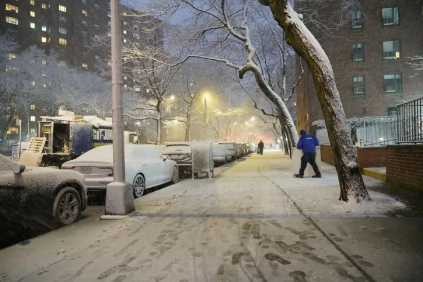
New York is bracing for another round of winter weather as the latest snow storm weather forecast NYC highlights accumulating snow, gusty winds and frigid temperatures moving into the region. Forecasters say the developing system could bring measurable snowfall to parts of the city and surrounding boroughs beginning late Tuesday into Wednesday, February 24–25, 2026 (ET).
The updated snow forecast shows a fast-moving system, but one capable of disrupting commutes and midweek travel plans.
Snow Storm Weather Forecast NYC: Timing and Impacts
The current snow storm weather forecast NYC calls for snow to begin after 10 p.m. ET Tuesday, with steadier bands overnight into early Wednesday morning. The heaviest snowfall rates are expected between 3 a.m. and 9 a.m. ET, potentially impacting the morning commute.
Projected impacts include:
-
Slippery roads and reduced visibility
-
Delays on bridges and elevated roadways
-
Possible school schedule adjustments
-
Flight delays at major airports
While totals are still being refined, early models suggest 2 to 5 inches across much of New York City, with locally higher amounts north and west of Manhattan.
Snow Forecast: How Much Could Fall?
The broader snow forecast for the tri-state area shows variation depending on elevation and distance from the coast.
Estimated Snow Totals (as of Monday afternoon, ET)
| Area | Projected Snowfall |
|---|---|
| Manhattan | 2–4 inches |
| Brooklyn & Queens | 2–3 inches |
| Bronx | 3–5 inches |
| Staten Island | 2–4 inches |
| Northern NJ & Lower Hudson Valley | 4–6 inches |
Meteorologists note that a slight shift in storm track could increase or decrease totals by 1–2 inches.
Temperatures are expected to hover near the freezing mark during peak snowfall, which may lead to a mix of snow and sleet in some coastal neighborhoods before transitioning back to snow.
New York Travel and Transit Concerns
City agencies are preparing salt spreaders and plows ahead of the anticipated snowfall. Officials are urging drivers to allow extra travel time and to avoid unnecessary trips during peak storm hours.
Subway service is expected to run, though above-ground lines may experience slower service if snow bands intensify. Commuters are advised to monitor transit alerts before heading out Wednesday morning.
Air travelers should check flight status updates, particularly at JFK and LaGuardia, where winter weather frequently leads to cascading delays.
What’s Driving This Snow Storm Weather Forecast?
The developing system is tied to a low-pressure area moving along the Mid-Atlantic coast before tracking northeastward. Cold air already in place over New York will allow precipitation to fall primarily as snow.
Forecasters caution that wind gusts up to 25–35 mph could create blowing snow, reducing visibility at times. Even moderate snowfall combined with gusty winds can lead to brief whiteout conditions.
Looking Ahead After the Snow
Once the storm exits late Wednesday afternoon, clearing skies are expected, but temperatures will remain below average through Thursday. Overnight lows could dip into the teens in parts of the metro area.
Long-range outlooks suggest another potential system next weekend, though details remain uncertain.
For now, residents across New York are encouraged to monitor the evolving snow storm weather forecast, prepare for slippery conditions, and stay updated as the snow forecast is refined in the coming hours.