


Chicago Weather: Winter Weather Advisory Brings Lake-Effect Snow and Slick Roads to Nearby Counties
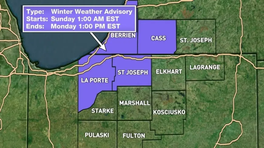
Chicago Weather update: a Winter Weather Advisory is in effect until 1 PM EST Monday for parts of Michigan and Indiana, bringing continuing lake-effect snow, gusty winds and slick road conditions that could affect morning commutes into Tuesday.
Chicago Weather: Advisory area, timing and immediate impacts
A Winter Weather Advisory is in effect until 1 PM EST Monday for Berrien and Cass counties in Michigan, and St. Joseph, Marshall, Starke, Elkhart, and LaPorte counties in Indiana. Lake-effect snow that began overnight continued into Monday morning, producing bands of heavier snow and widespread lighter snow through the afternoon. Snow will become lighter in the evening, but travel impacts remain a concern into the start of the workweek.
Snow totals, winds and temperatures to watch
Most of the area seeing snow will accumulate 1–3 inches through the afternoon. In the heaviest parts of the bands, another 3–4 inches will be possible. The best chances for heavier snow fall west of IN15, with the highest totals west of US31. A heavy band is present in the Michigan area, contributing to locally higher amounts.
- Expected accumulations: most areas 1–3 inches; heaviest bands 3–4 inches possible.
- Highest potential: west of IN15, especially west of US31.
- Winds: gusts of 20–30 mph with drifting snow.
- Temperatures: mid to upper 20s during the day; lows dropping to around 17.
- Wind chill: values in the 8–15 degree range through the day.
Travel implications and local disruptions
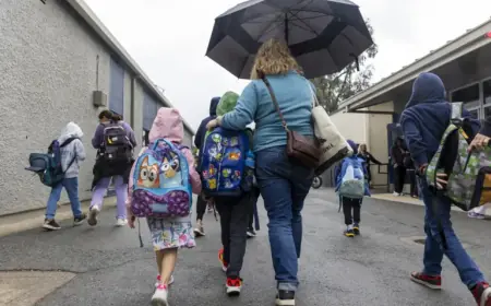
The combination of accumulating snow, gusty winds and low wind chills can create treacherous conditions on area roads. Visibility and icy conditions may be difficult during the morning commute on Monday and Tuesday. The snow and drifting are expected to affect road conditions for drivers, and closings and delays are already happening in the affected area.
Motorists should plan for slower travel, potential slick spots and reduced visibility in heavier bands. Snow that drifts because of 20–30 mph gusts can quickly reduce lane widths and make untreated surfaces hazardous. Even where totals remain near the lower end of the spectrum, wind-driven snow and low temperatures will maintain a risk of icy patches.
What to expect through tonight and Tuesday morning
Lake-effect snow bands will remain in place through the day before tapering off into the evening. Temperatures are expected to stay in the mid to upper 20s for most of the day, falling to lows near 17 overnight. Morning commutes on both Monday and Tuesday could see lingering impacts from slick surfaces and limited visibility where lingering snow or ice remain.
Updates and local adjustments to closings and delays are possible as conditions evolve. Recent observations show continuing lake-effect activity and localized heavier bands, so residents in the advisory area should remain prepared for hazardous driving conditions and brief periods of reduced visibility.
Schedule-sensitive travelers and those responsible for road clearance should monitor local conditions and plan accordingly; the advisory remains in place until 1 PM EST Monday and conditions are expected to change as snow tapers in the evening.