


Accuweather Forecasts Point to an Emerging El Niño — How U.S. Weather Patterns Could Shift Next
What changes next matters for coastlines, water managers and anyone planning for heat or storms. Forecasters now place a notable probability on El Niño forming in the months ahead, and accuweather forecasters view that as a turning point for the Atlantic hurricane season, western drought relief prospects and national temperature trends. The near-term shift could lower hurricane counts while re-routing rainfall and nudging global temperatures upward.
Accuweather’s consequence lens: hurricane shear, regional rainfall shifts and hotter years ahead
El Niño tends to change atmospheric wind patterns in ways that increase mid- to upper-level wind shear across the Atlantic Basin, which can make it harder for tropical storms to organize and strengthen. At the same time, the eastern Pacific often becomes more active for hurricanes. That trade-off is central to the practical consequences for emergency planners and insurers: fewer storms nearer the U. S. coast is possible, but increased activity far out over the ocean and stronger eastern Pacific storms are also possible.
Here’s the part that matters for many readers: an El Niño signal typically brings more rain to the southern U. S. and parts of southern Europe, while parts of the northern U. S. and Canada trend drier and warmer than normal. In the western U. S., the pattern can lift rainfall for basins that need relief, but it generally won’t erase existing drought.
Event details and what the forecasts are projecting
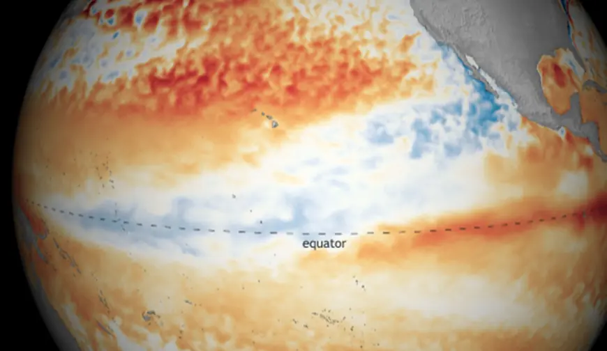
Two major weather prediction services place a substantial probability—up to 60 percent—on El Niño forming this summer. Forecasters note early warming in the tropical Pacific and rising subsurface temperature indicators; however, late winter and early spring remain a tricky window for long-range forecasting because models can be less reliable then. That uncertainty leaves space for the pattern to strengthen or stall over the coming months.
Recent seasonal behavior adds context: the most recent El Niño winters occurred in 2018–19 and 2023–24, and the year that ended with a La Niña pattern remained unusually warm. If an El Niño emerges as projected, climate models and forecast teams expect 2026 and 2027 to be hotter than the prior La Niña year.
- Hurricane season implication: increased Atlantic wind shear could reduce the number or intensity of storms near the U. S. coast; eastern Pacific activity may rise.
- Regional precipitation: southern U. S. and southern Europe more likely to see above-normal rainfall; northern U. S. and Canada lean drier and warmer.
- Temperature trend: a forming El Niño typically lifts global average temperatures, amplifying heat-related risks.
It’s easy to overlook, but the seasonal timing of El Niño’s development matters: an early start can influence late-summer moisture flows and autumn weather patterns differently than a late-blooming event. The real question now is how strongly the pattern will take hold before the Atlantic hurricane peak.
Micro Q&A
- Q: Who notices the change first? A: Coastal communities, water managers and emergency planners feel shifts in hurricane risk and rainfall distribution early in the season.
- Q: Will rain cure drought? A: Increased rainfall in key basins can help, but it typically isn’t enough to erase long-term drought on its own.
- Q: What would confirm a stronger El Niño trend? A: Continued warming of tropical Pacific subsurface and sustained sea-surface temperature increases would strengthen the signal.
What’s easy to miss is that a single El Niño event carries mixed effects: lower hurricane activity in one basin can coincide with heightened risk elsewhere, and higher average temperatures increase the energy available to extreme weather even as some storm types become less frequent. Recent updates indicate forecasts are leaning toward El Niño, but details may evolve as the spring predictability barrier clears.
If you’re wondering why this keeps coming up, planners and forecasters emphasize advance notice because it affects seasonal outlooks, resource allocation and emergency preparation across multiple regions.